Bayou St. John, Old River and Robinson Island bulkhead planning
On Bayou St. John, the bank you own decides the permit office. The north shore at Caswell is Orange Beach, while the Ono Island shore across the water is Baldwin County. Shallow water and new island restoration work add two more checks.
Describe your project on this page ↓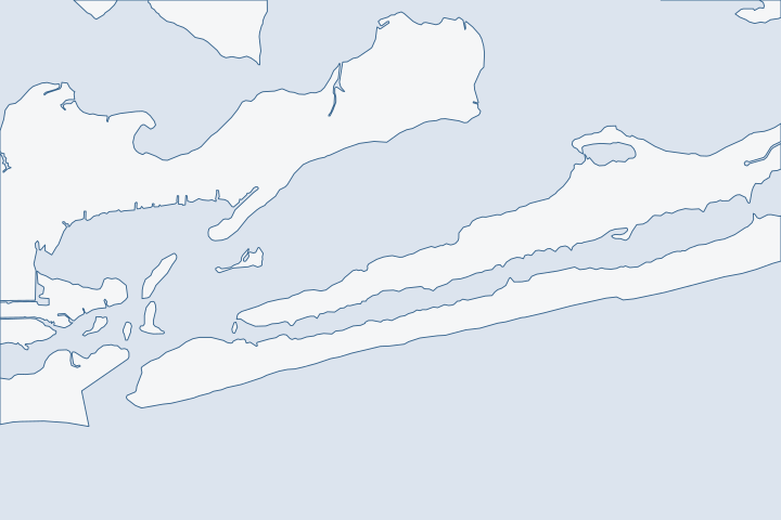
Bayou St. John, Old River & Robinson Island at a glance
- Who permits it
- City of Orange Beach at Caswell; Baldwin County Building for Ono Island frontage
- Call first
- Orange Beach Community Development, (251) 981-2610
- The water
- Bayou St. John, 62% hard armoring in 2012; Old River under a 24-foot fixed bridge
- Local rule to know
- Walker Island is closed, and Robinson and Bird island interiors are off limits
Get to know your waterfront
Bayou St. John is the marked route from Perdido Pass to the Intracoastal Waterway. Old River enters the pass from the east, and the Florida-Alabama line runs through it. Robinson, Walker and Bird islands sit off the pass. Alabama's end of Perdido Key lies east of it. Census boundary layers put Caswell inside Orange Beach but place the points for Robinson Island, Walker Island, Bayou St. John and Old River outside the city polygon.
U.S. Coast Pilot 5, Chapter 6 (edition dated 25 Oct 2026), paragraph 358 · GNIS Domestic Names - Alabama (DomesticNames_AL.txt, file dated 2026-09-30) · TIGERweb Census Current (2026) Legal and Statistical Entities, Incorporated Places layer (January 1, 2026 vintage), point-in-polygon queries · U.S. Coast Pilot 5, Chapter 6 (edition dated 25 Oct 2026), paragraphs 353 and 358
Read the bank, the depth and the islands before you design
Three local facts matter most on this water. Know which office permits your bank. Know how much water you really have. Know what public restoration work sits across from you.
Your bank sets your permit office
Orange Beach limits include the mainland shore at Caswell. Census city limits The opposite shore is Ono Island, which Baldwin County permits. The county's building jurisdiction covers all unincorporated land, plus three named towns. County building page
| Shoreline | Who permits it |
|---|---|
Caswell, north bank | City of Orange Beach. |
Ono Island frontage, south bank | Baldwin County Building Inspection. |
Robinson, Walker and Bird islands | City-owned preserves with posted rules. |
Old River, state line reach | Alabama rules stop at the boundary. |
On the Ono Island bank, read our Ono Island guide too. It covers the private association layer that sits on top of the county permit.
The channel is crowded with walls and short on depth
A state survey table lists Bayou St. John as the most armored water in Baldwin County. Hard structures cover 62% of its shoreline, mapped in 2012. Ono Island overall is 20%. Alabama armoring table Lighter armoring table A bayou that built out this far leaves few natural banks to absorb wave energy. Each wall faces another wall.
Depth is the second limit. Coast Pilot reports shoaling to 3 feet between Daybeacons 6 and 8 on the marked route. Coast Pilot 5 Its Old River entry gives an older figure. A depth of 5 feet could be carried through the river with local knowledge in 1982. A fixed highway bridge with 24 feet of clearance crosses about 1 mile east of the pass. Coast Pilot 5
- Sound the water at your own dock before you order a larger boat lift.
- Ask a barge contractor whether the bridge and shoaling limit equipment on your side.
- Expect work windows to follow the water level. Tides here are small, with a gauge range of 0.9 foot at Alabama Point. NOAA Alabama Point datums
Our docks and boat lifts page explains how lift size and water depth fit together.
The islands across the water are restoration sites
The islands are not empty land. The city bought Robinson Island in 2003 to keep it from development and runs it as a bird and wildlife sanctuary. City island page It also acquired Walker Island to preserve it. City 2019 report
The Lower Perdido Islands project finished in September 2025. It restored about 20 acres at Walker Island and about 7 acres at Robinson Island. Crews used about 170,000 cubic yards of sand to build dune, shrub platform, marsh and sand flats, and added riprap on the northeast end of Robinson. NOAA restoration site Phase II was listed at $9,452,000. ADCNR restoration plan notice
A NOAA Fisheries feature says the islands had been shrinking from storms, boat wake and the Deepwater Horizon spill. NOAA Fisheries feature The rules now in force:
- Walker Island is closed to visitors, and boaters have a no-wake zone. NOAA Fisheries feature
- Nobody may enter the interiors of Robinson or Bird island, because of shorebird nesting. City island rules
- No Motor Zones on the east side protect grass beds. City island rules
What does that mean for a private wall? Reviewers know these projects. A new structure that adds wake or shades grass beds near them will be weighed against the public investment. State Lands also prefers riprap and native plantings over vertical walls where they fit. State Lands shoreline rule See living shorelines and riprap options.
East of the pass, Perdido Key follows a different checklist
The Alabama tip of Perdido Key falls under the city's habitat plan for the Perdido Key beach mouse. The federal permit covers 73.744 acres of habitat and runs from 2021 to 2051. Fish and Wildlife permit summary Projects there must use shielded lighting, tinted glass and silt fence set off the ground so mice can pass. Permit site measures Most of that is beach work. Read the Gulf-front guide for the details.
The city has also tried to get a public boat launch on state land east of the Caribe condominiums. ADCNR did not approve the funding request, according to the 2019 city report. City 2019 report Public water access on this side stays limited.
When a living shoreline is worth a quote
Alabama's 2024 Joe Faust Living Shoreline Act lets State Lands permit a residential owner to dredge sand within the riparian area to build a living shoreline. The dredge fee is half the normal rate, and the law's stated purpose is to favor living shorelines over vertical walls. Joe Faust Living Shoreline Act
The federal permit for these projects covers low- to mid-energy shores. It requires fringe marsh or oyster reef, and a notice to the Corps for each new project. 2026 Nationwide Permit 54 A busy channel with heavy wake may not be low energy. Ask an engineer whether your stretch qualifies before you count on it.
ADEM also asks an applicant to rule out non-structural options before armoring. ADEM bulkhead rule Even if you still choose a wall, a short written note on why a soft option failed protects your application.
Storms hit the bayou from behind
Sally's worst damage fell along the back bays from east of Gulf Shores to the state line. Flooding peaked at 5 to 7 feet over the ground, and the water moved large boats onto land and destroyed many docks and piers. NHC Sally report In Katrina, the Perdido Pass gauge logged 5.8 feet MSL, far below the readings in Mobile Bay. NWS Katrina table Use the storm inspection guide after any named storm.
What could the work cost?
Price access first on this water. Shoaling, a low fixed bridge and a crowded channel can push barge time and rock delivery costs higher than the wall itself. Ask every bidder to name the route they will use, and to give lift and wall work as separate lines. Compare ranges on the cost guide. In unincorporated Baldwin County, a marine accessory flood permit is $75 inside a mapped flood zone.
Orange Beach permit values are what applicants declared for fee purposes, not invoices. Public bids carry bonding and county terms. Prices for steel, concrete, composite and aluminum come from outside Alabama and are labeled with their geography.
Compare quotes and plan a budget →Find the relevant permits and records
| Starting point | What to resolve | Prepare and look up |
|---|---|---|
City of Orange Beach (Caswell shore) | City Site Permit for the wall. Lots on the south side of Highway 182 add a coastal use review. | Community Development, (251) 981-2610. Coastal Resources, (251) 981-1063. File through the city permit portal. |
Baldwin County Building Department (Ono Island frontage) | Flood permit with the marine accessory subtype, applied for in the county portal. | (251) 972-6837. Attach the Corps permit and the State Lands notice, and add an electrical permit for any wiring. |
Corps of Engineers Regulatory Division, Mobile | Federal sign-off on bank work, usually written under Nationwide Permit 13. | (251) 690-2658. The permit stays simple only while the wall is under 500 feet and averages one cubic yard or less of fill per foot. |
Alabama State Lands Division | State bottom consent. A replacement wall may sit no more than two feet waterward of the high tide line. | (251) 621-1238. State Lands prefers riprap and native plantings over vertical walls where they work. |
City Coastal Resources (island rules) | Questions about Robinson and Bird island access, events and No Motor Zones. | (251) 981-1063. Call before you plan barge landings near the islands. |
ADEM Coastal Program | State coastal review. ADEM asks the owner to show that a living or soft option was weighed first. | (251) 304-1176. Fee is $1,000 up to 50 feet and $1,665 beyond 50 feet. |
Bayou St. John and Old River pre-bid checklist
Four checks from public records. Run them before you sign a scope of work.
Identify your bank on the parcel viewer
Switch on both jurisdiction layers. Caswell lots may show as city lots, while Ono Island lots show as county lots.
Permitting FAQs | Baldwin County Building Department · TIGERweb Census Current (2026) Legal and Statistical Entities, Incorporated Places layer (January 1, 2026 vintage), point-in-polygon queries
Sound the water at your dock
Charted depth is old and the marked route shoals. Ask for a soundings sheet at the face of your wall before any lift is ordered.
U.S. Coast Pilot 5, Chapter 6 (edition dated 25 Oct 2026), paragraphs 353 and 358 · U.S. Coast Pilot 5, Chapter 6 (edition dated 25 Oct 2026), paragraph 358
Check the bridge and barge route
The Old River span has a 24-foot clearance. If equipment must pass it, get the contractor's route in writing.
U.S. Coast Pilot 5, Chapter 6 (edition dated 25 Oct 2026), paragraph 358
Ask about island rules and the no-wake zone
Call the city office about island access, No Motor Zones and the Walker Island no-wake area. They may affect where work boats can land or anchor.
Robinson Island & Bird Island · Restoring Alabama's Lower Perdido Islands to Protect Wildlife and Coastal Communities
Tell us about your bayou or Old River wall
Tell us which bank you are on, the depth at your dock and any damage you can see. We can help you line up the next step with a local marine contractor who knows this water.
Built on Baldwin County permit rules, Alabama coastal law, public records and storm data.
Bayou St. John, Old River & Robinson Island project questions
I live on the Ono Island side of Bayou St. John. Does the city permit my wall?
No. Ono Island sits outside every city, so Baldwin County Building handles the permit. A private owners association adds its own review. See the Ono Island guide for that layer.
Building Inspection · TIGERweb Census Current (2026) Legal and Statistical Entities, Incorporated Places layer (January 1, 2026 vintage), point-in-polygon queries
Why is Bayou St. John so heavily walled?
A state shoreline survey found hard armoring on 62% of its shore, the highest of any Baldwin County water in the table. With walls on both banks, each one faces another.
How deep is Old River?
An old Coast Pilot report says boats could carry 5 feet through the river with local knowledge in 1982. A 24-foot fixed bridge crosses it. Sound your own dock rather than trust a number that old.
U.S. Coast Pilot 5, Chapter 6 (edition dated 25 Oct 2026), paragraph 358
Can I land a work boat on Robinson or Walker Island?
Not on the interiors. The city bars access for nesting shorebirds, and Walker Island is closed to visitors. No Motor Zones protect grass beds on the east side. Call the city at (251) 981-1063 before planning any landing.
Robinson Island & Bird Island · Restoring Alabama's Lower Perdido Islands to Protect Wildlife and Coastal Communities
What changed on the islands recently?
A restoration project finished in September 2025. It rebuilt about 20 acres at Walker Island and about 7 acres at Robinson Island, with a monitoring period of at least five years.
Lower Perdido Islands Restoration Completed in Orange Beach, Alabama
Keep planning
Nearby waterfront guides
Ono Island, Cotton Bayou, Terry Cove & Perdido Pass, Gulf-front Orange Beach
Show sourcesHide sources
- U.S. Coast Pilot 5, Chapter 6 (edition dated 25 Oct 2026), paragraph 358Source reviewed 2026-10-31
- GNIS Domestic Names - Alabama (DomesticNames_AL.txt, file dated 2026-09-30)Source reviewed 2026-10-31
- TIGERweb Census Current (2026) Legal and Statistical Entities, Incorporated Places layer (January 1, 2026 vintage), point-in-polygon queriesSource reviewed 2026-10-31
- Building InspectionSource reviewed 2026-10-31
- Robinson Island & Bird IslandSource reviewed 2026-10-31
- Coastal Alabama Living Shorelines Policies, Rules, and Model Ordinance Manual (Boyd and Pace; supported by the Mobile Bay National Estuary Program)Source reviewed 2026-10-31
- CO-OPS datums: 8730667 Alabama Point, ALSource reviewed 2026-10-31
- 2006-2020 City Projects Associated with Horizons 2020 Recommendations (revised August 27, 2019)Source reviewed 2026-10-31
- Lower Perdido Islands Restoration Completed in Orange Beach, AlabamaSource reviewed 2026-10-31
- Alabama Trustees Release Restoration Plan IV with $24.1 Million in Coastal Restoration ProjectsSource reviewed 2026-10-31
- Restoring Alabama's Lower Perdido Islands to Protect Wildlife and Coastal CommunitiesSource reviewed 2026-10-31
- ADCNR Admin. Code r. 220-4-.09 Placement and Configuration of Piers and Other Improvements on State Owned Submerged LandsSource reviewed 2026-10-31
- Native Endangered Species Habitat Conservation Plan permit ES48931D (Incidental Take Permit PDF)Source reviewed 2026-10-31
- Code of Alabama 1975 Sec. 9-7-13.1, Dredging of Material for Use in Constructing a Residential Living ShorelineSource reviewed 2026-10-31
- 2026 Nationwide Permit 54, Living Shorelines, 91 FR 768Source reviewed 2026-10-31
- ADEM Admin. Code r. 335-8-2-.06 Shoreline Stabilization and Erosion MitigationSource reviewed 2026-10-31
- National Hurricane Center Tropical Cyclone Report: Hurricane Sally, 11-17 September 2020Source reviewed 2026-10-31
- Hurricane Katrina - August 2005 (observed storm surge data)Source reviewed 2026-10-31
- Permit Portal | Orange Beach, ALSource reviewed 2026-10-31
- Orange Beach Code of Ordinances Ch. 30, Art. VII Coastal Construction (Municode, Supp. 40)Source reviewed 2026-10-31
- Coastal Resources - AboutSource reviewed 2026-10-31
- Permit Application Checklists | Baldwin County Building DepartmentSource reviewed 2026-10-31
- Contact Us | Baldwin County Building DepartmentSource reviewed 2026-10-31
- Alabama Coastal Area Management Program (ADEM Coastal Program page)Source reviewed 2026-10-31
- ADEM Admin. Code Chapter 335-1-6 Application Fees, adopted rule effective October 15, 2026Source reviewed 2026-10-31
- Permitting FAQs | Baldwin County Building DepartmentSource reviewed 2026-10-31
- Baldwin County Building Inspection Department Fee Schedule (effective 10/01/2023, updated 10/01/2024)Source reviewed 2026-10-31