
Fairhope bayfront and Fly Creek bulkhead planning
Inside city limits, the City of Fairhope permits a bay wall, pier or lift. On a Single Tax lease, the Fairhope Single Tax Corporation must also sign as landowner. Because the city's limits are patchy along the water, confirm the parcel is really inside them.
Describe your project on this page ↓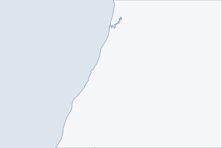
Fairhope bayfront & Fly Creek at a glance
- Who permits it
- City of Fairhope Building Inspection and Permitting inside city limits, Baldwin County outside them
- Call first
- Fairhope Building Inspection, (251) 990-0153
- The water
- Open Mobile Bay below the bluff, the 1,448-foot municipal pier and Fly Creek
- Local rule to know
- On a Single Tax lease, the corporation signs the permit application as landowner
Get to know your waterfront
Fairhope counted 22,477 residents in 2020. Its limits run from about latitude 30.512 to 30.582 in 44 separate pieces, with unincorporated gaps between them. The shore is a bluff above Mobile Bay. The municipal pier, 1,448 feet long, was destroyed by Katrina in 2005 and rebuilt in 2006. Fly Creek, to the north, has a federal channel 6 feet deep and 80 feet wide.
TIGERweb Census 2020 layers (Incorporated Places / Census Designated Places), POP100 and HU100 fields · TIGERweb Census Current (2026) Legal and Statistical Entities, Incorporated Places layer (January 1, 2026 vintage), point-in-polygon queries · Community Parks and Trails · USACE National Channel Framework, ChannelReach layer (Mobile District, CESAM), channel area CESAM_FC_01_FYC
Who owns the land, and what the city's own wall teaches
Two questions come before any design. Who owns the dirt, and is the lot really in the city?
The Single Tax signature and the city line
The Single Tax Corporation owns about 4,500 acres in and around Fairhope, roughly a quarter of the city. Lessees own their house and improvements but lease the land. A building permit application needs the corporation's signature as landowner. The office is at 336 Fairhope Avenue, (251) 928-8162. Single Tax Corporation Add that step to the schedule for any wall, pier or lift.
Then settle the city line. Fairhope's polygon has 44 pieces, and grid sampling finds gaps along the Montrose shore. Census boundary layers Outside the city, Baldwin County permits the work. County permit jurisdiction
| Work | Office or rule |
|---|---|
City building and land use permits | Building Inspection and Permitting, 555 South Section Street |
Pier or boathouse setbacks | Zoning code exemption for state submerged land |
Floodplain and erosion controls | Same city office: floodplain, stormwater, erosion rules |
Water bottom | State Lands, the Corps and ADEM, as on any Alabama shore. |
The zoning code defines a waterfront lot as any lot next to Mobile Bay, and exempts structures over state submerged land from front and side yard setbacks for accessory structures.
What the pier seawall shows
The city's own bay wall is the local case study. It is about 50 years old. Storms including Sally and Zeta weakened its anchoring hardware, sections shifted and water washed soil out from behind it. City of Fairhope The fix is part of an almost $10 million project, funded by RESTORE Act money. The contract went to Rolin Construction in April 2024, and crews were retrofitting the tiebacks on the precast wall's south side. City of Fairhope
Zeta damaged that wall in 2020. NHC Zeta report A survey team found 7 to 9 feet of inundation in northeast Mobile Bay from the Causeway south to the shores of Fairhope. NHC Zeta report FEMA's records for Sally include about $368,000 for Fairhope boat docks. FEMA Public Assistance
- Look for panels that have shifted or leaned since the last storm.
- Look for failed tiebacks, the buried rods or cables that hold the wall back.
- Look for sinkholes or voids behind the cap.
Older private walls fail the same way. See tiebacks and anchors and soil loss and drainage.
Beaches behind hard walls
Beaches south of the pier that showed in 1955 are now "strikingly absent," largely because of shoreline hardening. A sand beach survives north of it. Eastern Shore watershed plan The estuary program says vertical walls hurt habitat at their base and throw wave energy onto neighbors. Eastern Shore watershed plan
| Basin | Total shore | Detail |
|---|---|---|
Fly Creek and tributary 4 | 20,791 feet | 11,336 feet bulkhead, 500 jetty, 8,762 natural |
Around the pier | 12,817 feet | 4,523 feet bulkhead, 1,822 nourished beach, 578 seawall, 5,743 natural |
The data are from the estuary plan. Eastern Shore watershed plan A sloped rock or living-shoreline toe in front of an aging wall can protect both the wall and the beach. The plan also notes permitting hurdles for living shorelines, such as coastal property rights and rock on state submerged land. Eastern Shore watershed plan See the living shoreline guide.
Gullies, Fly Creek and the water coming down the bluff
Upland water matters as much as bay water on a bluff lot. Estimated sediment loads beat the natural erosion rate in every Eastern Shore basin. Tatumville Gully ran 5,581 tons per square mile a year and Rock Creek 4,644, against a natural rate of 64. Eastern Shore watershed plan
Fly Creek is classified for swimming and fishing, and the state listed it as impaired in 2018 for pathogens. MBNEP summary Fairhope Docks, on Fly Creek at 848 Sea Cliff Drive, is city-owned. It now allows boat lifts for slip holders and closes in hurricane watches. City of Fairhope The Fairhope Bayfront District is on the National Register, so ask the city whether your lot lies inside it. Eastern Shore watershed plan
Piers, lifts and the bay-front lot rules
A pier on a Fairhope waterfront lot is an accessory structure. The zoning code lets it sit in front of or beside the house, at least 10 feet away. Zoning Ordinance 1253 The state and the Corps set the rest.
- ADEM requires pilings that let tides flow, with platforms at the waterward end and no habitable space. ADEM pier rule
- The Corps pier permit allows a terminal structure up to 3,000 square feet and a length of no more than a quarter of the waterway's width. Nothing may sit within 100 feet of a federal channel, unless waived. Corps pier permit limits
- State Lands lets a dock serving a single home use a Consent of Use when the footprint stays under 5,000 square feet. State Lands rule
That 100-foot channel rule matters on Fly Creek, which has a federal channel. See docks and boat lifts.
Public land, ramps and the water you share
The city became caretaker of the beachfront park, the bluff park lands and the pier in the 1930s, all gifts of the Single Tax Colony. City of Fairhope Ramps sit at 1 Pier Avenue, Magnolia Beach Park and North Beach Park, and the Pier Street ramp has two lanes and three courtesy docks. City of Fairhope
Fly Creek's tide range is 1.7 feet at the NOAA station, the widest on this shore. NOAA tide stations Jubilees can hit the whole shore from Daphne to Mullet Point, about 15 miles, or only a few hundred feet of beach. City of Fairhope Neighbors will be at the waterline on those mornings, so keep the work site tidy.
The city is also building the 108-acre Flying Creek Nature Preserve between Veterans Boulevard and the creek, with a kayak launch planned in phase 2. City of Fairhope
What could the work cost?
Price the Single Tax lease step and the survey separately from the wall. City fees listed in the schedule include $100 for a residential Board of Adjustment request and $50 for a zoning verification letter. Ask bidders to quote tieback replacement apart from panel repair. See costs per foot.
Orange Beach permit values are what applicants declared for fee purposes, not invoices. Public bids carry bonding and county terms. Prices for steel, concrete, composite and aluminum come from outside Alabama and are labeled with their geography.
Compare quotes and plan a budget →Find the relevant permits and records
| Starting point | What to resolve | Prepare and look up |
|---|---|---|
City of Fairhope Building Inspection and Permitting | Building and land use permits for walls, piers and lifts inside city limits. | 555 South Section Street, information line (251) 990-0153, email buildingpermits@fairhopeal.gov. Open Monday to Friday, 7 a.m. to 4 p.m. |
Fairhope Single Tax Corporation | Landowner signature on the permit application when the lot is a leasehold. | 336 Fairhope Avenue, (251) 928-8162. Bring the lease and the plans. |
Baldwin County Building Department | Parcels outside the city's patchwork limits. | Call (251) 972-6837 or visit 1100 Fairhope Avenue. |
Corps of Engineers Mobile District | Bank stabilization or pier work over tidal water. | Phone (251) 690-2658. Bank work over 500 feet needs a notice first. |
State Lands and ADEM | Use of state bottoms, plus coastal review. | State Lands, (251) 621-1216, wants a $100 Request to Impact. ADEM's coastal line is (251) 304-1176. |
A Fairhope pre-bid checklist
Work through four steps in order. The first two cost nothing.
Find out if the lot is a Single Tax lease
Call the corporation and ask whether the parcel is a leasehold. If so, schedule the signature early.
Check the parcel against city limits
Use the county viewer's City Limits layer. Gaps in the city's patchwork send some bayfront lots to the county.
Permitting FAQs | Baldwin County Building Department · TIGERweb Census Current (2026) Legal and Statistical Entities, Incorporated Places layer (January 1, 2026 vintage), point-in-polygon queries
Ask the city for a zoning verification
The city charges $50 for a zoning verification letter. Ask it to confirm the zoning and how the waterfront-lot setback exemption applies to your site.
City of Fairhope Ordinance No. 1763 (Planning and Zoning user fees) · City of Fairhope Zoning Ordinance No. 1253, amended June 3, 2025
Inspect the wall after every storm
Photograph panel lines, the cap and the ground behind it, then compare with last year's photos before asking for bids.
Plan your Fairhope bayfront project
Say whether the lot is on the bluff, the beach or Fly Creek and whether it is leased from the Single Tax Corporation. A local marine contractor can follow up once we know the site.
Built on Baldwin County permit rules, Alabama coastal law, public records and storm data.
Fairhope bayfront & Fly Creek project questions
Does a Single Tax lease change who permits my bulkhead?
No, but it adds a signature. The city still reviews the permit, and the Single Tax Corporation signs as landowner on the application.
Can I pull my own permit as an owner?
The owner of record may, by attesting in writing that they personally do the work. Owners may hire licensed subcontractors, and state law bars selling a new single-family home for 12 months after it is finished.
What went wrong with the city's pier seawall?
After storms including Sally and Zeta, the anchoring hardware weakened, sections shifted and soil eroded behind the wall. The city is retrofitting the tiebacks.
Is the whole bayfront inside city limits?
No. The city's limits come in 44 pieces along the shore, with unincorporated gaps. Check each parcel on the county viewer.
TIGERweb Census Current (2026) Legal and Statistical Entities, Incorporated Places layer (January 1, 2026 vintage), point-in-polygon queries · Permitting FAQs | Baldwin County Building Department
Can I add a boat lift at Fairhope Docks?
Slip holders at the city-owned docks may now install boat lifts. Call the office at (251) 929-0365 before buying equipment.
Keep planning
Nearby waterfront guides
Point Clear, Battles Wharf & Mullet Point, Daphne & Montrose, Weeks Bay, Fish River & Marlow
Show sourcesHide sources
- TIGERweb Census 2020 layers (Incorporated Places / Census Designated Places), POP100 and HU100 fieldsSource reviewed 2026-10-31
- TIGERweb Census Current (2026) Legal and Statistical Entities, Incorporated Places layer (January 1, 2026 vintage), point-in-polygon queriesSource reviewed 2026-10-31
- Community Parks and TrailsSource reviewed 2026-10-31
- USACE National Channel Framework, ChannelReach layer (Mobile District, CESAM), channel area CESAM_FC_01_FYCSource reviewed 2026-10-31
- F.A.Q.sSource reviewed 2026-10-31
- Permitting FAQs | Baldwin County Building DepartmentSource reviewed 2026-10-31
- Building and Permitting | City of Fairhope, ALSource reviewed 2026-10-31
- City of Fairhope Zoning Ordinance No. 1253, amended June 3, 2025Source reviewed 2026-10-31
- ADCNR Admin. Code Chapter 220-4 (State Lands Division), r. 220-4-.09 Placement and Configuration of Piers and Other Improvements on State Owned Submerged LandsSource reviewed 2026-10-31
- Working WaterfrontSource reviewed 2026-10-31
- National Hurricane Center Tropical Cyclone Report: Hurricane Zeta, 24-29 October 2020Source reviewed 2026-10-31
- OpenFEMA Public Assistance Funded Projects Details (v2), DR-4563, Baldwin CountySource reviewed 2026-10-31
- Eastern Shore Watershed Management Plan (final, August 16, 2023)Source reviewed 2026-10-31
- Eastern Shore (watershed page)Source reviewed 2026-10-31
- Fairhope Docks MarinaSource reviewed 2026-10-31
- ADEM Admin. Code Chapter 335-8-2, rule 335-8-2-.05 Piers, Docks, Boathouses, and Other Pile Supported StructuresSource reviewed 2026-10-31
- ALGP-05 Piers and Pile-Supported Structures (SAM-2025-00970-LHL), 2026 Alabama General Permit ProgramSource reviewed 2026-10-31
- HistorySource reviewed 2026-10-31
- CO-OPS datums: 8733821 Point Clear, 8733502 Fly Creek, 8733839 Meaher State Park, 8732828 Weeks BaySource reviewed 2026-10-31
- Jubilee InformationSource reviewed 2026-10-31
- Flying Creek Nature PreserveSource reviewed 2026-10-31
- Contact Us | Baldwin County Building DepartmentSource reviewed 2026-10-31
- South Atlantic Division > Missions > Regulatory > AlabamaSource reviewed 2026-10-31
- 2026 Nationwide Permit 13, Bank Stabilization, 91 FR 768Source reviewed 2026-10-31
- Contact Us (Alabama Department of Conservation and Natural Resources)Source reviewed 2026-10-31
- Alabama Coastal Area Management Program (ADEM Coastal Program page)Source reviewed 2026-10-31
- City of Fairhope Ordinance No. 1763 (Planning and Zoning user fees)Source reviewed 2026-10-31
- Contractor Licensing | City of Fairhope, ALSource reviewed 2026-10-31