
Magnolia Springs and Magnolia River bulkhead planning
In Magnolia Springs, the town issues a Land Use Certificate, and Baldwin County issues the building permit. The lower river toward Weeks Bay is not in the town at all. The Magnolia River is an Outstanding Alabama Water, so silt and new hardening draw extra attention.
Describe your project on this page ↓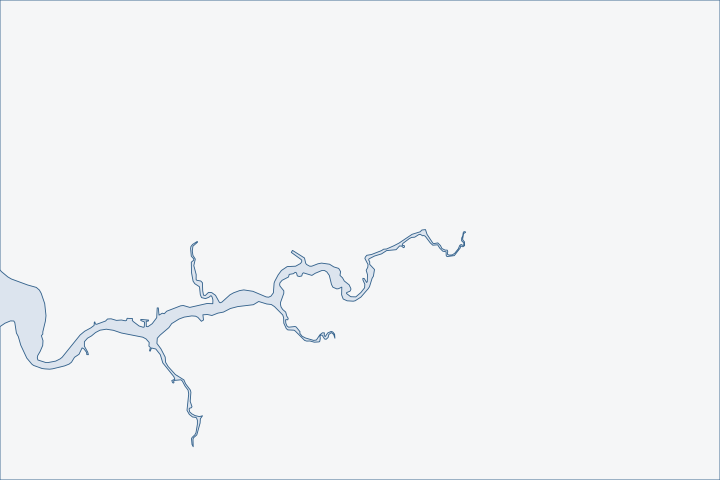
Magnolia Springs & the Magnolia River at a glance
- Who permits it
- Baldwin County Building Department, after a Land Use Certificate from the town if the lot is inside it
- Call first
- Town of Magnolia Springs Town Hall, (251) 965-9888
- The water
- Magnolia River, an Outstanding Alabama Water from Weeks Bay to 10 feet above mean sea level
- Local rule to know
- The town requires a Land Use Certificate before the county issues a building permit
Get to know your waterfront
The Town of Magnolia Springs counted 811 residents in 2020. It is one small polygon of about 2.65 square kilometers. The mouth of the Magnolia River and Weeks Bay fall outside it, so the lower river is unincorporated county even where addresses say Magnolia Springs. The town's history page says boathouses line each shore of the river, which was once the highway for steamers and sailboats.
TIGERweb Census 2020 layers (Incorporated Places / Census Designated Places), POP100 and HU100 fields · TIGERweb Census Current (2026) Legal and Statistical Entities, Incorporated Places layer (January 1, 2026 vintage), point-in-polygon queries · History of Magnolia Springs
What to settle before a Magnolia River wall or pier is designed
Settle three things first: whether your lot is inside the town and what the Outstanding Alabama Water rule means for the job. Then ask how a pier change affects the mail. This river runs on rules written to protect it.
Town first, then county, or county alone
Baldwin County's Building Department permits and inspects construction inside the Town of Magnolia Springs. The town requires its own Land Use Certificate first. Town building page Town permit path Outside the town, the county's Planning and Zoning Department applies. County building jurisdiction
| Where the lot sits | Steps |
|---|---|
Inside the town | Town Land Use Certificate, then county building permit |
Lower river, outside the town | County flood permit, Marine Accessory; county zoning review |
Lot with a pier, boathouse or lift | Corps and State Lands paperwork in either case. |
Magnolia Springs Town Hall is at (251) 965-9888.
County rules apply in the town too. The county's floodplain ordinance reaches unincorporated land and three towns, Magnolia Springs among them. Floodplain ordinance The county flood permit fee is $75, with a $15 processing fee and a $10 issuance fee on top. County fee schedule Check the town website before you apply, since its home page listed a zoning text amendment hearing for November 3, 2026. Town Hall, as read October 31, 2026
The river is the street
A highway contract carrier based in Magnolia Springs delivers mail by boat to 180 homes along a 31-mile route. Residents keep mailboxes at the ends of their piers. USPS Employee News The town says the river remains the only river route mail delivery in the continental United States. Town history If you rebuild a pier on the route, keep the box reachable from the water, and tell the carrier before a long outage.
- A depth of about 4 feet can be carried into the river from Weeks Bay. Coast Pilot 5
- Coast Pilot 5 says small boats go to Magnolia Springs. Coast Pilot 5
- Barge access depends on that shallow entrance, so ask each bidder for the draft of its equipment.
An Outstanding Alabama Water
The state lists the Magnolia River from Weeks Bay to 10 feet above mean sea level as an Outstanding Alabama Water. It is also classed for swimming and fish and wildlife. ADEM use classification The river has held that status since 2009, and Weeks Bay itself has been an Outstanding National Resource Water since 1992. Weeks Bay watershed plan Local volunteers trained by Alabama Water Watch helped win the designation, and they revived the group in March 2025. Town of Magnolia Springs
The reserve's core area includes the water bottoms of the Magnolia River up to the point where tides end. Reserve management plan State rules say uses inside the reserve that would alter its natural state may not be allowed. ADEM reserve rule In practice, that means plan silt control for the whole job, and ask early whether a softer bank treatment fits.
Why a new wall stands out
A 2009 state survey found that only 2.5 of the Magnolia River's 15.4 miles of shore, about 16.5%, had hard protection, mostly bulkheads. The rest, 83.5%, was natural. Weeks Bay watershed plan That is far less armor than most Baldwin County waters. Armoring survey Replacing an old wall at its existing line is the easiest path. State rules allow replacement at or within two feet waterward of mean high tide with a Consent of Use. State Lands replacement rule
Two river features add to the review. Wild celery grass beds were mapped in the river between Nolte Creek and Eslava Branch. Underwater grass survey Heavy boat traffic and wakes may be eroding small islands on the lower river. Weeks Bay plan Wake is a reason to size a bulkhead for more than storm waves. Look at the living shorelines guide for a bank that is still natural.
What public bluff repairs show
The grant money on this river points to softer methods. A $9,003,000 award in November 2022 funds repairs to eroded stream segments in the watershed. NFWF award The project restores about 3,131 feet of Schoolhouse Branch and four bluffs on the Magnolia River east of town, over 900 feet in all. MBNEP project summary It uses natural channel design modeled on the D'Olive watershed program. That shows the kind of bank treatment funders accept on this river.
The Alabama Coastal Area Act protects riparian rights, including piers on pilings that allow tides to flow. Coastal Area Act Federal pier permits for Weeks Bay have their own limits, including a 300-foot length cap and a 620-square-foot terminal structure. Corps general permit Confirm with the Corps whether those limits reach your lot.
Tied-up boats and a softer bank by law
Alabama law makes it an offense to tie a boat to a lawfully built bulkhead or piles after the owner has warned you within the past 12 months. Code of Alabama Sec. 33-7-9 River owners with busy neighbors can use that warning before wake and strain damage a wall.
The Joe Faust Living Shoreline Act of 2024 lets State Lands permit a residential owner to dredge sand and sediment from the owner's own riparian area. The purpose is to build a living shoreline. The dredge fee is half the normal fee. Living Shoreline Act That can lower the cost of a soft bank on a river where reviewers prefer one. The HOA seawall repair page covers shared river frontage.
High water and storms on Weeks Bay
NOAA's Weeks Bay gauge ran from 2007 until April 2022. It recorded Hurricane Nate at 4.3 feet above the average high-water line in 2017 and Zeta at 4.2 feet in 2020. CO-OPS top ten Gauge history Nate damaged just under 200 piers across Baldwin County. NWS Mobile Nate report Isaac in 2012 put a storm tide of 4.5 feet at the gauge. NWS Mobile Isaac report
Magnolia Springs is absent from FEMA's discount program, so policies inside town get no discount. Unincorporated Baldwin County is Class 7, with a 15% discount. FEMA CRS list County CRS class Read about wall damage in the storm guide.
What could the work cost?
Magnolia River jobs often need silt control for the whole project, a shallow-draft access plan and a design that keeps pier mailboxes reachable. Ask bidders to price each separately. See the cost guide for ranges.
Orange Beach permit values are what applicants declared for fee purposes, not invoices. Public bids carry bonding and county terms. Prices for steel, concrete, composite and aluminum come from outside Alabama and are labeled with their geography.
Compare quotes and plan a budget →Find the relevant permits and records
| Starting point | What to resolve | Prepare and look up |
|---|---|---|
Town of Magnolia Springs | Land Use Certificate, required before the county issues a building permit inside the town. | Parcel address and project description; ask about the town's flood-zone, land-disturbance and culvert forms. Town Hall, (251) 965-9888. |
Baldwin County Building Department | Flood Permit (Marine Accessory) for shoreline work in a flood hazard zone; also issues building permits inside the town. | Attach Corps and State Lands papers and create a portal login. (251) 972-6837. |
U.S. Army Corps of Engineers, Mobile District | Federal permit; Weeks Bay pier limits may apply. | Drawings showing mean high water and the pile line. (251) 690-2658. |
Alabama State Lands Division, Coastal Section | Consent of Use for work over state-owned river bottom. | Notice of intent, proof of upland ownership and a survey. (251) 621-1216. |
Magnolia Springs pre-bid checklist
Do these four checks before the bids come in, using public records.
Find out whether the lot is in the town
Use the county Parcel Viewer's city limits layer. Many river addresses say Magnolia Springs but sit in the county.
Permitting FAQs | Baldwin County Building Department · TIGERweb Census Current (2026) Legal and Statistical Entities, Incorporated Places layer (January 1, 2026 vintage), point-in-polygon queries
Ask the town for its forms
If you are inside the town, request the Land Use Certificate and any flood-zone or land-disturbance form before the county application.
Building | Magnolia Springs AL · History of Magnolia Springs
Check the bank's history
Search the county portal for permits since November 2020, then compare dated aerials to see how the bank looked before any wall.
Search Permits, Reports, Certificates of Occupancy, & Elevation Certificates | Baldwin County Building Department · Weeks Bay Watershed Management Plan (final, prepared by Thompson Engineering for MBNEP)
Plan the mail and the draft
If your pier carries a mailbox, ask the carrier about outages. Give bidders the shallow entrance depth from Weeks Bay.
On the waterfront: Contract carrier enjoys unusual route · United States Coast Pilot 5, Chapter 7 (Mobile Bay; pages dated 25 Oct 2026)
Tell us about your Magnolia River wall or pier
Say whether you are inside the town, how your bank looks and whether a mailbox rides on your pier. A qualified marine contractor can take it from there.
Built on Baldwin County permit rules, Alabama coastal law, public records and storm data.
Magnolia Springs & the Magnolia River project questions
Does the Town of Magnolia Springs issue my building permit?
No. Baldwin County issues and inspects it. The town requires a Land Use Certificate first, and you can reach Town Hall at (251) 965-9888.
Building | Magnolia Springs AL · History of Magnolia Springs
My address says Magnolia Springs. Is my river lot in the town?
Maybe not. The lower river from the town to Weeks Bay, including the mouth, is unincorporated county land.
What does Outstanding Alabama Water status mean for my bulkhead?
The river is one of the state's most protected waters, so expect careful review of silt, runoff and any new hardening. Plan sediment control for the whole job.
Can I rebuild a pier that holds a mailbox?
Yes, but keep the box reachable from the water. The boat carrier serves about 180 homes on a 31-mile route.
Why do public bluff repairs here avoid walls?
Grant-funded repairs on this river use natural channel design. That shows what funders accept on banks that are mostly still natural.
Weeks Bay (watershed page) · Weeks Bay Watershed Management Plan (final, prepared by Thompson Engineering for MBNEP)
Keep planning
Nearby waterfront guides
Weeks Bay, Fish River & Marlow, Bon Secour & the Bon Secour River, Point Clear, Battles Wharf & Mullet Point
Show sourcesHide sources
- TIGERweb Census 2020 layers (Incorporated Places / Census Designated Places), POP100 and HU100 fieldsSource reviewed 2026-10-31
- TIGERweb Census Current (2026) Legal and Statistical Entities, Incorporated Places layer (January 1, 2026 vintage), point-in-polygon queriesSource reviewed 2026-10-31
- History of Magnolia SpringsSource reviewed 2026-10-31
- Building | Magnolia Springs ALSource reviewed 2026-10-31
- Building InspectionSource reviewed 2026-10-31
- Permit Application Checklists | Baldwin County Building DepartmentSource reviewed 2026-10-31
- Floodplain Management / Flood Zone Info | Baldwin County Building DepartmentSource reviewed 2026-10-31
- Baldwin County Building Inspection Department Fee Schedule (effective 10/01/2023, updated 10/01/2024)Source reviewed 2026-10-31
- Home Page | Magnolia Springs ALSource reviewed 2026-10-31
- On the waterfront: Contract carrier enjoys unusual routeSource reviewed 2026-10-31
- United States Coast Pilot 5, Chapter 7 (Mobile Bay; pages dated 25 Oct 2026)Source reviewed 2026-10-31
- Certification of Administrative Rules: 335-6-11-.02 Use Classifications (ADEM Water Division, filed April 15, 2025)Source reviewed 2026-10-31
- Weeks Bay Watershed Management Plan (Thompson Engineering for the Mobile Bay National Estuary Program)Source reviewed 2026-10-31
- Magnolia RiverSource reviewed 2026-10-31
- Weeks Bay National Estuarine Research Reserve Management Plan 2026-2031Source reviewed 2026-10-31
- ADEM Admin. Code Chapter 335-8-1, rule 335-8-1-.04 Special Management AreasSource reviewed 2026-10-31
- Coastal Alabama Living Shorelines Policies, Rules, and Model Ordinance Manual (Boyd and Pace; supported by the Mobile Bay National Estuary Program)Source reviewed 2026-10-31
- ADCNR Admin. Code r. 220-4-.09 Placement and Configuration of Piers and Other Improvements on State Owned Submerged LandsSource reviewed 2026-10-31
- Lower Fish River Watershed Restoration - Phase II (Alabama at a Glance)Source reviewed 2026-10-31
- Weeks Bay (watershed page)Source reviewed 2026-10-31
- Code of Alabama 1975 Sec. 9-7-13, Activities Deemed Permissible Uses Within Coastal AreaSource reviewed 2026-10-31
- ALGP-05 Piers and Pile-Supported Structures, special conditions SP-11 to SP-13Source reviewed 2026-10-31
- Code of Alabama 1975 Sec. 33-7-9, Trespass After Warning on Booms, Bulkheads or Piles Erected by Riparian ProprietorsSource reviewed 2026-10-31
- Code of Alabama 1975 Sec. 9-7-13.1, Dredging of Material for Use in Constructing a Residential Living ShorelineSource reviewed 2026-10-31
- CO-OPS Top Ten Water Levels: 8732828 Weeks Bay, Mobile Bay, ALSource reviewed 2026-10-31
- CO-OPS station metadata: 8732828 Weeks Bay, Mobile Bay, ALSource reviewed 2026-10-31
- Hurricane Nate - October 7-8, 2017Source reviewed 2026-10-31
- Hurricane Isaac - August 2012 (Post-Tropical Cyclone Report)Source reviewed 2026-10-31
- CRS Eligible Communities, October 1, 2026 Effective DateSource reviewed 2026-10-31
- Contact Us | Baldwin County Building DepartmentSource reviewed 2026-10-31
- South Atlantic Division > Missions > Regulatory > AlabamaSource reviewed 2026-10-31
- Contact Us (Alabama Department of Conservation and Natural Resources)Source reviewed 2026-10-31
- Permitting FAQs | Baldwin County Building DepartmentSource reviewed 2026-10-31
- Search Permits, Reports, Certificates of Occupancy, & Elevation Certificates | Baldwin County Building DepartmentSource reviewed 2026-10-31