Cotton Bayou, Terry Cove and Perdido Pass seawall planning
A bulkhead on Cotton Bayou or Terry Cove is permitted by the City of Orange Beach, not by Baldwin County. Boat wake, a sand-hungry pass and jetty-driven current shape these walls more than open-bay wind does.
Describe your project on this page ↓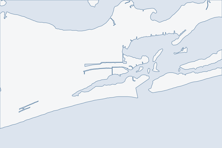
Cotton Bayou, Terry Cove & Perdido Pass at a glance
- Who permits it
- City of Orange Beach Community Development, 4101 Orange Beach Boulevard
- Call first
- Orange Beach Coastal Resources, (251) 981-1063
- The water
- Perdido Pass federal channel, 12 feet deep and 150 feet wide at the entrance
- Local rule to know
- Lots south of Highway 182 need city coastal use review
Get to know your waterfront
Perdido Pass runs between Florida Point and Alabama Point. The State Route 182 bridge crosses it on two fixed spans, with 54 feet of clearance over the pass channel and 41 feet over the Cotton Bayou channel. Past the bridge the dredged channel forks. One arm runs north into Terry Cove and Johnson Cove. The other runs east toward Bayou St. John. Cotton Bayou sits on the west side, about 0.7 mile above the entrance, and several small-craft facilities line the coves.
U.S. Coast Pilot 5, Chapter 6 (edition dated 25 Oct 2026), Big Lagoon to Old River, paragraph 354 · U.S. Coast Pilot 5, Chapter 6 (edition dated 25 Oct 2026), paragraph 354 · U.S. Coast Pilot 5, Chapter 6 (edition dated 25 Oct 2026), paragraph 358 · GNIS Domestic Names - Alabama (DomesticNames_AL.txt, file dated 2026-09-30)
What decides a wall on the pass and its coves
Three things set the plan on these shores: who issues the permit, how much wake and current the wall takes, and how the pass itself behaves. Settle them in that order.
The city issues the permit, and the rules come in layers
Census boundary layers run the Orange Beach polygon east past Perdido Pass to about longitude -87.514. Alabama Point sits inside it, and so do the Cotton Bayou and Terry Cove shores. Census city limits Confirm your own parcel before you call anyone.
| Work | Office and permit type |
|---|---|
Bulkhead or seawall | City Site Permit, filed through the online permit portal. |
Pier, dock or boathouse | City Building Permit under the marine accessory category. |
Lot south of Highway 182 | Coastal use review through the city's Coastal Resources office. |
Bottom of the cove or pass | State Lands and the Corps of Engineers. |
A recent city record shows what a replacement looks like on paper. A 2021 Site Permit covered a new bulkhead built in front of a damaged one. It had front pilings and landside deadman pilings, a $60,000 job value and $85 in city fees. City permit ST21-000353 A deadman is a buried anchor that holds the wall back against the soil. See tiebacks and anchors for how those work.
Wake does more damage here than wind
These coves hold marinas, public launches and island lots, so boats pass all day. In 2019 the city lobbied Alabama Marine Police to widen idle-speed zones in Terry Cove, Cotton Bayou and the islands north of the pass. The stated goal was less island shoreline erosion. City 2019 accomplishments report
Repeated small waves hit the toe of a wall again and again. Water then scours the sand in front and pulls soil out through weak joints. Ask any bidder how the design handles toe scour. A wall that looks sound above the water can be losing fill behind it. Read about soil loss and drainage before you accept a patch.
Next door on the Bayou St. John channel, hard armoring covers 62% of the shoreline. Alabama shoreline armoring table Walls that face each other across a narrow channel bounce wake back and forth. That is another reason to check the cap and the toe together.
Perdido Pass moves sand, and the channel moves with it
The ebb shoal outside the jetties covers about 240 acres and holds roughly 3.0 to 3.4 million cubic yards of sand. Olsen ebb shoal report A 2006 study called the pass a substantial sink for sand from the beach system. It also noted that the Corps and the State own the inlet water bottoms. Olsen sediment report
- The federal outer channel is authorized at 12 feet deep and 150 feet wide. Inner reaches are 9 feet deep and 100 feet wide. Corps channel framework
- The city paid $800,000 to have dredged pass sand placed on its own beach, about half the cost of dredging alone. City Horizons 2020 report
- The Corps posted condition surveys of the pass channel on 24 February 2026 and 3 August 2026. Corps eHydro surveys
Do not assume the charted depth in front of your dock. Ask a contractor to sound the bottom before choosing a lift or a barge route.
What Sally and the older storms left behind
Sally's surge reached 5 to 7 feet above ground along the county coast in 2020. The worst damage was in the back bays east of Gulf Shores toward the state line. Many docks and piers were destroyed. NHC Sally report NWS surveyed 7 to 9 feet of inundation in parts of Orange Beach and noted a damaged walkway at the Cotton Bayou Gulf access. NWS Sally county report
Public works show the same repair cycle. The city bid its Perdido Pass Seawall Park repairs in January 2023 under FEMA Project No. 181334. The scope covered timber boardwalk, timber landscape walls, riprap and pile cap repairs. City bid notice FEMA records also list more than $520,000 for Perdido Pass projects after Sally. FEMA Public Assistance records
The gauge at Alabama Point recorded a great diurnal range of only 0.9 foot, so daily tides are small. NOAA Alabama Point datums Storms are what test a wall. Peak levels at the pass reached 8.8 feet NGVD in Ivan in 2004 and 5.6 feet in Georges in 1998. Corps tide-gage table Our storm guide covers what to inspect after one.
Public structures beside your private wall
Your wall may end at a public one. On January 11, 2024, the Alabama Department of Conservation and Natural Resources reported that the fishing area on the west side of the pass had been renovated. It had partly reopened. The area directly under the bridge stayed closed while work continued. ADCNR announcement The city was also building a new Coastal Resources office and marina facility on Terry Cove in 2019. City 2019 accomplishments report
- Ask who owns the last section of wall at each property line, you or the public agency.
- Record the cap height on both sides of every joint before work starts.
- Photograph the toe at low water so a later dispute has a baseline.
Public walls are rebuilt on public budgets and calendars. A private wall that ties into one needs a written plan for who pays when the two settle differently.
Lifts, piers and the launch ramps nearby
Piers and boathouses need their own building permit. The city charges $3 per $1,000 of value, with a $25 minimum, and $30 for a boat lift electrical permit. City fee schedule Public ramps at Cotton Bayou and Boggy Point give a view of the water from the public side. Cotton Bayou Launch Boggy Point Launch Our docks and boat lifts page covers sizing.
What could the work cost?
Ask each bidder to price three things apart from the wall: access by barge or by land, toe protection against wake, and the buried anchors. City fees are small, so most of your cost sits in engineering, materials and the water-side work. The city lists a first site-permit review at 14 days and revisions at 7. See bulkhead costs per foot for the Baldwin County ranges.
Orange Beach permit values are what applicants declared for fee purposes, not invoices. Public bids carry bonding and county terms. Prices for steel, concrete, composite and aluminum come from outside Alabama and are labeled with their geography.
Compare quotes and plan a budget →Find the relevant permits and records
| Starting point | What to resolve | Prepare and look up |
|---|---|---|
City of Orange Beach Community Development | Site Permit for a bulkhead or seawall, plus a separate Building Permit for any pier or boathouse. | 4101 Orange Beach Boulevard, (251) 981-2610. A bulkhead permit is $50 for a one- or two-family home and $100 for commercial or multi-family, plus $25 issuance and $10 data processing. |
City of Orange Beach Coastal Resources | Coastal use review when the lot lies south of Highway 182 or touches the Coastal Construction Line (CCL). | 4697 Walker Avenue, (251) 981-1063. Ask before drawings are final, since a formal review adds public notice time. |
U.S. Army Corps of Engineers, Mobile District | Federal authorization for work in tidal waters, often under Nationwide Permit 13 for bank stabilization. | (251) 690-2658. A notice is needed if the work runs past 500 feet or averages more than one cubic yard of fill per foot below high tide. |
Alabama State Lands Division | Consent for work on state-owned bottom, including a replacement wall set at or within two feet waterward of mean high tide. | (251) 621-1238. Bring a survey that shows the mean high water line. |
ADEM Coastal Program | State coastal review of shoreline stabilization on non-Gulf-fronting lots. | (251) 304-1176. Fees are $1,000 for 50 feet or less and $1,665 for more than 50 feet, with a bulkhead or riprap. |
Pre-bid checklist for a Cotton Bayou or Terry Cove wall
Five checks, each from a public record. Do them before you invite bids.
Search the city permit portal for your address
The portal lists permits issued after 2018. Filter by permit type to find earlier bulkhead work on the lot. Monthly reports back to 2021 show what neighbors built.
Confirm the parcel is inside city limits
Open the Baldwin County parcel viewer and switch on the city limits and building permit jurisdiction layers. A parcel in neither is permitted by the county.
Ask Coastal Resources about Highway 182
Tell the office whether the lot is north or south of the highway. South-side lots go through coastal use review before work starts.
Orange Beach Code of Ordinances Ch. 30, Art. VII Coastal Construction (Municode, Supp. 40) · Coastal Resources - About
Pull the latest pass survey
Look up the Corps eHydro condition surveys of Perdido Pass Channel. They show what the channel looks like now, not what it was authorized to be.
USACE eHydro Survey Data (feature service) · National Channel Framework, ChannelReach layer (channel area CESAM_PP_01_PPC, Perdido Pass Channel)
Ask Marine Police about idle-speed zones
Find out whether your frontage sits in a posted zone. It tells you how much wake the wall will face and how long a pier can run.
2006-2020 City Projects Associated with Horizons 2020 Recommendations (revised August 27, 2019)
Tell us about your Cotton Bayou or Terry Cove wall
Share your street, the cove or channel you face and what you see on the wall. We will help you plan the next step and put you in touch with a local marine contractor who works the pass.
Built on Baldwin County permit rules, Alabama coastal law, public records and storm data.
Cotton Bayou, Terry Cove & Perdido Pass project questions
Does the city or the county permit a Terry Cove bulkhead?
The City of Orange Beach does, for lots inside its limits. Census boundary layers place the Terry Cove and Cotton Bayou shores inside the city. Check your parcel on the county viewer to be sure.
TIGERweb Census Current (2026) Incorporated Places layer (January 1, 2026 vintage), point-in-polygon and grid sampling · Permitting FAQs | Baldwin County Building Department
What does the city charge for a bulkhead permit?
The permit fee is $50 for a one- or two-family home and $100 for commercial or multi-family. Add $25 for issuance and $10 for data processing. Starting work without a permit doubles the permit fee.
Permit Fee Schedule (Orange Beach Community Development, 2026.03)
Does the wall need coastal use review if I am south of Highway 182?
Yes. The city code requires anyone building on a property south of the highway, or touching the construction line, to apply for coastal use review. Call Coastal Resources at (251) 981-1063 early.
Orange Beach Code of Ordinances Ch. 30, Art. VII Coastal Construction (Municode, Supp. 40) · Coastal Resources - About
Can I build a new wall in front of the old one?
Often yes, within limits. State Lands allows a consent of use for a replacement at or within two feet waterward of mean high tide. Anything farther out needs more review.
Does dredging at Perdido Pass change my permit?
Not your permit, but it changes your site. The Corps and the State own the inlet water bottoms, and dredge cycles bring barges and pipe near the coves. Depth also shifts between cycles.
Orange Beach / Gulf State Park / Gulf Shores 2006 Phase I Deep-Water Sand Search, Baldwin County, AL (November 2006) · National Channel Framework, ChannelReach layer (channel area CESAM_PP_01_PPC, Perdido Pass Channel)
Keep planning
Nearby waterfront guides
Bayou St. John, Old River & Robinson Island, Gulf-front Orange Beach, Ono Island
Show sourcesHide sources
- U.S. Coast Pilot 5, Chapter 6 (edition dated 25 Oct 2026), Big Lagoon to Old River, paragraph 354Source reviewed 2026-10-31
- GNIS Domestic Names - Alabama (DomesticNames_AL.txt, file dated 2026-09-30)Source reviewed 2026-10-31
- TIGERweb Census Current (2026) Incorporated Places layer (January 1, 2026 vintage), point-in-polygon and grid samplingSource reviewed 2026-10-31
- Permit Portal | Orange Beach, ALSource reviewed 2026-10-31
- Orange Beach Code of Ordinances Ch. 30, Art. VII Coastal Construction (Municode, Supp. 40)Source reviewed 2026-10-31
- ADCNR Admin. Code Chapter 220-4 (State Lands Division), r. 220-4-.09 Placement and Configuration of Piers and Other Improvements on State Owned Submerged LandsSource reviewed 2026-10-31
- Orange Beach Building Department monthly permits report, October 2021 (PDF)Source reviewed 2026-10-31
- 2006-2020 City Projects Associated with Horizons 2020 Recommendations (revised August 27, 2019)Source reviewed 2026-10-31
- Coastal Alabama Living Shorelines Policies, Rules, and Model Ordinance Manual (Boyd and Pace; supported by the Mobile Bay National Estuary Program)Source reviewed 2026-10-31
- Orange Beach / Gulf State Park / Gulf Shores 2006 Phase I Deep-Water Sand Search, section 4.3 Perdido Pass Ebb ShoalSource reviewed 2026-10-31
- National Channel Framework, ChannelReach layer (channel area CESAM_PP_01_PPC, Perdido Pass Channel)Source reviewed 2026-10-31
- USACE eHydro Survey Data (feature service)Source reviewed 2026-10-31
- National Hurricane Center Tropical Cyclone Report: Hurricane Sally, 11-17 September 2020Source reviewed 2026-10-31
- Hurricane Sally - September 16, 2020 (Post-Tropical Cyclone Report, updated 10 Oct 2020)Source reviewed 2026-10-31
- Contract Documents, General Conditions, and Project Specifications: Perdido Pass Seawall Park Post-Hurricane Sally Repairs, FEMA Project #181334, & Phase III Expansion (City Requisition No. 2023-0223)Source reviewed 2026-10-31
- OpenFEMA Public Assistance Funded Projects Details (v2), DR-4563, Baldwin CountySource reviewed 2026-10-31
- CO-OPS datums: 8730667 Alabama Point, ALSource reviewed 2026-10-31
- Hurricane Ivan - September 16, 2004 (Table 3, observed storm surge data, courtesy USACE Mobile District)Source reviewed 2026-10-31
- Beach Renourishment Continues Along Alabama CoastSource reviewed 2026-10-31
- Permit Fee Schedule (Orange Beach Community Development, 2026.03)Source reviewed 2026-10-31
- Public Boat LaunchesSource reviewed 2026-10-31
- Coastal Resources - AboutSource reviewed 2026-10-31
- 2026 Nationwide Permit 13, Bank Stabilization, 91 FR 768Source reviewed 2026-10-31
- Permit Application Checklists | Baldwin County Building DepartmentSource reviewed 2026-10-31
- ADEM Form 166, Joint Application and Notification (rev. 8/19)Source reviewed 2026-10-31
- Alabama Coastal Area Management Program (ADEM Coastal Program page)Source reviewed 2026-10-31
- ADEM Admin. Code Chapter 335-1-6 Application Fees, adopted rule effective October 15, 2026Source reviewed 2026-10-31
- Building Department Monthly Reports | Orange Beach, ALSource reviewed 2026-10-31
- Permitting FAQs | Baldwin County Building DepartmentSource reviewed 2026-10-31
- Application Review Times (Orange Beach Building Department, 2025.05)Source reviewed 2026-10-31