Bon Secour bulkhead and shoreline planning
Bulkhead repair in Bon Secour goes through Baldwin County, because the village is unincorporated. A river lot near Highway 59 may instead sit inside Foley or Gulf Shores. This is a working river, so channel and wake rules matter.
Describe your project on this page ↓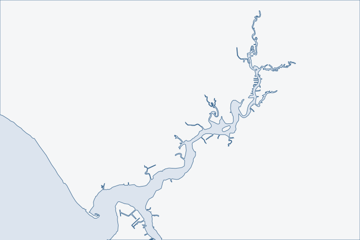
Bon Secour & the Bon Secour River at a glance
- Who permits it
- Baldwin County, with Foley or Gulf Shores only inside their limits
- Call first
- Baldwin County Building Department, (251) 972-6837
- The water
- The Bon Secour River, with a federal channel 10 feet deep to Day Marker 30, and Bon Secour Bay
- Local rule to know
- State Lands rules require a 100-foot gap between structures and a federal channel
Get to know your waterfront
Census data list Bon Secour as a place without a municipal government, with 1,754 residents in 2020. Only about half of the land in its ZIP area is inside that census boundary, so a Bon Secour address does not settle who permits a lot. The river rises in Foley, flows about 8 miles south and southwest into Bon Secour Bay, and reaches Oyster Bay through its South Fork. It is about 2,000 feet wide at the mouth.
TIGERweb Census Current (2026) Census Designated Places layer; Census 2020 layer; 2020 ZCTA-to-place relationship file · TIGERweb Census 2020 layers (Incorporated Places / Census Designated Places), POP100 and HU100 fields · Bon Secour River, Oyster Bay, and Skunk Bayou Watershed Management Plan (January 2017)
What to settle before a Bon Secour wall is designed
Settle three things first: which government holds the parcel and which reach of the river you are on. Then check how close the wall or pier sits to the federal channel. The river changes character every mile.
County land, with city pockets upstream
The county's Building Inspection and Planning and Zoning offices cover the village and the river mouth. The City of Foley or Gulf Shores applies only where a parcel lies inside those limits. County building jurisdiction A county bulkhead or pier is applied for as a Flood Permit, Marine Accessory sub-type. County marine permit
| Where the lot is | Office and fee |
|---|---|
Village or river mouth, unincorporated | County flood permit: $75, plus $25 processing and issuance |
Upstream lot inside Foley | City riparian structure permit: $75 new, $25 repair |
Lot inside Gulf Shores | City building permit after Corps and State Lands approval. |
Foley's code requires a riparian permit for new bulkheads and for repairs to structures damaged more than 50 percent. Foley riparian code Call the Foley Building Department at (251) 952-4011 if the parcel is in the city. Foley building office
A working river with a federal channel
The Corps maintains a federal channel 10 feet deep and 80 feet wide up to Day Marker 30, then 6 feet deep and 80 feet wide beyond it. The South Fork channel is also 10 by 80 feet. Corps channel framework Two turning basins lie on the south side of the river. Coast Pilot 5 Seafood houses and commercial boats still work near the mouth. Bon Secour plan
Keep any new pier or wall well clear of the marked channel and the basins. Expect commercial wakes and early-morning traffic if you are near the fish houses. State Lands rules also require a 100-foot gap between a structure on state bottom and a federal channel. State Lands rule The dock and boat lift page covers pier basics.
A fishing village formed along the river in the late 19th century, and shellfishing became its main industry. Bon Secour plan South Fork Channel leaves the river about a mile above the mouth and runs 1.1 miles toward Oyster Bay. Small-craft yards there and at Bon Secour offer berths, fuel, ramps and repairs. Coast Pilot 5 A fixed bridge on South Fork stops anything bigger than a skiff, so the Intracoastal and Oyster Bay guide covers the far side.
Know which reach you are on
The plan's field survey splits the river into zones. From County Road 12 to Keller Road, only canoes, kayaks and jon boats can travel. From Keller Road to County Road 10, larger boats run and homes line both banks, some with riprap and bulkheads. In the lowest zone most banks have homes, and seafood businesses sit near the mouth. River zones
- The river's coastal zone has more than 30 miles of tidal shore, most of it natural, with about 5 miles of wood and steel bulkhead. 2011 shoreline study
- The state measured the Bon Secour River system at about 28.8% armored, lighter than the Intracoastal Waterway at 51.1%. Armoring survey Waterway armoring
- Replacing a wall in a developed reach is routine. Hardening a natural bank upstream is the kind of change reviewers question.
The open bay shore favors breakwaters
West of the river, nearly 98% of the 6 miles of bay shoreline in the Skunk Bayou watershed was natural in 2011. The Nature Conservancy and partners built about a third of a mile of offshore breakwaters there in 2012. Skunk Bayou project The later Swift Tract project built about 1.6 miles of breakwater to protect marsh, with construction starting October 8, 2016. NOAA project record The watershed plan recommends living shorelines in the river, Oyster Bay and Skunk Bayou watersheds. Living shoreline plan
The bay is also shellfish water. Oyster beds are very extensive along its northeast shore, and the state classes the bay for shellfish harvesting. Coast Pilot 5 ADEM use classes Part of the bay bottom belongs to the Weeks Bay reserve core, where uses that would alter the natural state may not be allowed. Reserve management plan ADEM reserve rule The living shorelines guide explains the options.
Water quality shapes reviews
The whole river has been on Alabama's impaired-waters list since 2006 for mercury. The bay has been listed since 1998 for pathogens. Septic systems and runoff are named as likely sources. Impaired waters list Keep construction runoff and any drain field in mind when you plan the backfill.
What a recent public job cost nearby
In April 2024 the county took bids for The Launch at CR 6, a county boat launch on the lower river. Total bids were roughly $5.2 million to $5.5 million. CR 6 bid totals Installed loose riprap was bid at $71 to $150 per square yard for the thinnest class and $118 to $175 for the thickest. CR 6 riprap bids A launch is far larger than a house lot, so use it only as a unit-price check.
Buying or selling a river lot
Alabama treats used homes as buyer beware. The Alabama Real Estate Commission says no warranty comes with a used home. Real Estate Commission In a Baldwin County case on Fish River, buyers lost a claim after a bluff, part of a bulkhead and a boathouse collapsed months after closing. They lost because they had signed an as-is contract. Kidd v. Benson They had not had the bluff or bulkhead inspected. Case facts Buyers on this river should read the buyer guide, and fish-house owners can start with the marina and commercial page.
Storms on Bon Secour Bay
Sally dropped 29.3 inches of rain near Fort Morgan in 2020. NHC Sally report Rain, not only surge, loads the backfill, so look at drainage in the soil loss and drainage page.
What could the work cost?
On the river, price deliveries by water against overland access and check the channel before you place a pile line. Ask bidders to price demolition and riprap separately. See the cost guide for ranges.
Orange Beach permit values are what applicants declared for fee purposes, not invoices. Public bids carry bonding and county terms. Prices for steel, concrete, composite and aluminum come from outside Alabama and are labeled with their geography.
Compare quotes and plan a budget →Find the relevant permits and records
| Starting point | What to resolve | Prepare and look up |
|---|---|---|
Baldwin County Building Department | Marine Accessory flood permit for lots in the village and at the river mouth. | Attach the Corps permit, the State Lands notice and proof of ownership. (251) 972-6837. |
City of Foley Environmental Department | Riparian structure permit for a parcel inside Foley, such as an upstream river lot. | Site plan, copies of state and federal permits and the fee. Building office, (251) 952-4011. |
U.S. Army Corps of Engineers, Mobile District | Federal permit; a wall or pier near the maintained channel needs early review. | Drawings showing the channel, Day Markers and mean high water. (251) 690-2658. |
Alabama State Lands Division, Coastal Section | Consent of Use or easement over river and bay bottom. | Notice of intent, upland proof and survey. (251) 621-1216. |
Bon Secour pre-bid checklist
Finish these four checks before you ask for river bids.
Check city limits on the parcel viewer
Switch on the parcel viewer's city and jurisdiction layers. A river lot near Highway 59 may be inside Foley or Gulf Shores.
Permitting FAQs | Baldwin County Building Department · Building Inspection
Find your reach of the river
Match your lot to the plan's zones: upstream canoe water, the developed middle reach or the lower river with seafood businesses.
Bon Secour River, Oyster Bay, and Skunk Bayou Watershed Management Plan (January 2017)
Mark the channel and basins
Ask the engineer to draw the federal channel and turning basins on the site plan, then keep every pile line clear of them.
USACE National Channel Framework, ChannelReach layer (Mobile District, CESAM), channel areas CESAM_BS_01_BSR and CESAM_BS_02_SFC · United States Coast Pilot 5, Chapter 7 (Mobile Bay; pages dated 25 Oct 2026)
Read the deed and permit history
Search the Probate Office's official records online, and the CitizenServe portal for permits since November 2020.
Recording | Baldwin County Probate Office · Search Permits, Reports, Certificates of Occupancy, & Elevation Certificates | Baldwin County Building Department
Tell us about your Bon Secour shoreline
Give your street, your reach of the river and what you see at the wall. We will help you sort out what comes next with a local marine contractor.
Built on Baldwin County permit rules, Alabama coastal law, public records and storm data.
Bon Secour & the Bon Secour River project questions
Is my Bon Secour address in Baldwin County's permit area?
Most likely, since the village is unincorporated. Only about half of the ZIP area's land is inside the census place, and the upper watershed reaches into Foley and Gulf Shores, so check the parcel.
TIGERweb Census Current (2026) Census Designated Places layer; Census 2020 layer; 2020 ZCTA-to-place relationship file · Building Inspection
How close can my pier be to the Bon Secour channel?
State Lands rules require 100 feet between a structure and a federal channel. The Corps maintains the channel at 10 feet deep to Day Marker 30.
ADCNR Admin. Code r. 220-4-.09 Placement and Configuration of Piers and Other Improvements on State Owned Submerged Lands · USACE National Channel Framework, ChannelReach layer (Mobile District, CESAM), channel areas CESAM_BS_01_BSR and CESAM_BS_02_SFC
Can I replace a bulkhead the same as I replace one on a canal?
In a developed reach it is routine. The state measured the river system as about 28.8% armored, so adding a wall to a natural upstream bank draws more review.
Coastal Alabama Living Shorelines Policies, Rules, and Model Ordinance Manual (Boyd and Pace; supported by the Mobile Bay National Estuary Program) · Bon Secour River, Oyster Bay, and Skunk Bayou Watershed Management Plan (January 2017)
Is a living shoreline realistic on the bay shore?
Local projects have used offshore breakwaters, including about 1.6 miles at Swift Tract, and the watershed plan recommends living shorelines throughout.
DWH - AL Swift Tract Living Shoreline (Restoration Center project record) · Bon Secour River, Oyster Bay, and Skunk Bayou Watershed Management Plan (January 2017)
Does the impaired-waters listing stop a seawall job?
No, but it shapes the review. Septic systems and runoff are named sources, so plan runoff control and watch the drain field.
Bon Secour River, Oyster Bay, and Skunk Bayou Watershed Management Plan (January 2017)
Keep planning
Nearby waterfront guides
Intracoastal Waterway & Oyster Bay, Gulf Shores, Fort Morgan Peninsula, Magnolia Springs & the Magnolia River
Show sourcesHide sources
- TIGERweb Census Current (2026) Census Designated Places layer; Census 2020 layer; 2020 ZCTA-to-place relationship fileSource reviewed 2026-10-31
- TIGERweb Census 2020 layers (Incorporated Places / Census Designated Places), POP100 and HU100 fieldsSource reviewed 2026-10-31
- Bon Secour River, Oyster Bay, and Skunk Bayou Watershed Management Plan (January 2017)Source reviewed 2026-10-31
- Building InspectionSource reviewed 2026-10-31
- Permit Application Checklists | Baldwin County Building DepartmentSource reviewed 2026-10-31
- Baldwin County Building Inspection Department Fee Schedule (effective 10/01/2023, updated 10/01/2024)Source reviewed 2026-10-31
- City of Foley Code Ch. 4, Art. VIII Shoreline Construction Activities (Secs. 4-221 to 4-232), Ord. No. 1024-08Source reviewed 2026-10-31
- City of Gulf Shores Building Department, Building Permitting Procedures Handbook (2025)Source reviewed 2026-10-31
- Building Department | City of FoleySource reviewed 2026-10-31
- USACE National Channel Framework, ChannelReach layer (Mobile District, CESAM), channel areas CESAM_BS_01_BSR and CESAM_BS_02_SFCSource reviewed 2026-10-31
- United States Coast Pilot 5, Chapter 7 (Mobile Bay; pages dated 25 Oct 2026)Source reviewed 2026-10-31
- ADCNR Admin. Code r. 220-4-.09 Placement and Configuration of Piers and Other Improvements on State Owned Submerged LandsSource reviewed 2026-10-31
- Coastal Alabama Living Shorelines Policies, Rules, and Model Ordinance Manual (Boyd and Pace; supported by the Mobile Bay National Estuary Program)Source reviewed 2026-10-31
- DWH - AL Swift Tract Living Shoreline (Restoration Center project record)Source reviewed 2026-10-31
- Ala. Admin. Code r. 335-6-11-.02, Use Classifications (ADEM Water Division; amendment adopted 2025-04-11, filed 2025-04-15, effective 2025-06-14)Source reviewed 2026-10-31
- Weeks Bay National Estuarine Research Reserve Management Plan 2026-2031Source reviewed 2026-10-31
- ADEM Admin. Code Chapter 335-8-1, rule 335-8-1-.04 Special Management AreasSource reviewed 2026-10-31
- The Launch at CR 6 - Bid Tabulation (HW21103000)Source reviewed 2026-10-31
- Consumer Information (Alabama Real Estate Commission)Source reviewed 2026-10-31
- Kidd v. Benson, Supreme Court of Alabama, No. 1190413 (released September 4, 2020)Source reviewed 2026-10-31
- National Hurricane Center Tropical Cyclone Report: Hurricane Sally, 11-17 September 2020Source reviewed 2026-10-31
- Contact Us | Baldwin County Building DepartmentSource reviewed 2026-10-31
- South Atlantic Division > Missions > Regulatory > AlabamaSource reviewed 2026-10-31
- Contact Us (Alabama Department of Conservation and Natural Resources)Source reviewed 2026-10-31
- Permitting FAQs | Baldwin County Building DepartmentSource reviewed 2026-10-31
- Recording | Baldwin County Probate OfficeSource reviewed 2026-10-31
- Search Permits, Reports, Certificates of Occupancy, & Elevation Certificates | Baldwin County Building DepartmentSource reviewed 2026-10-31