Intracoastal Waterway and Oyster Bay bulkhead planning
Bulkhead work on the Intracoastal Waterway in Gulf Shores goes to the city if your lot is inside city limits and to Baldwin County if it is not. Oyster Bay shores can sit on either side of that line, so check the parcel before you call anyone.
Describe your project on this page ↓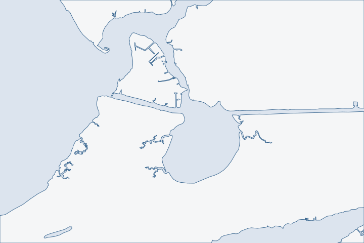
Intracoastal Waterway & Oyster Bay, Gulf Shores at a glance
- Who permits it
- City of Gulf Shores inside city limits; Baldwin County where Oyster Bay lots fall outside them
- Call first
- Gulf Shores Building Department for city lots, (251) 968-1150
- The water
- The Intracoastal Waterway, kept at 12 feet deep and 150 feet wide, and Oyster Bay
- Local rule to know
- State rules keep structures at least 100 feet from a federal channel
Get to know your waterfront
The City of Gulf Shores straddles the Intracoastal Waterway and reaches north to about latitude 30.334. Yet both Oyster Bay map points test outside the city, even though the city surrounds much of that area. The waterway opened in 1937 and gave the Gulf Shores area its first easy access, and the Alabama Supreme Court upheld the city's incorporation in 1958. The waterway runs through a long land cut from Wolf Bay at Mile 160.0 through Oyster Bay to Bon Secour Bay at Mile 151.0.
TIGERweb Census Current (2026) Legal and Statistical Entities, Incorporated Places layer (January 1, 2026 vintage), point-in-polygon queries · Gulf Shores · United States Coast Pilot 5, Chapter 12 (Intracoastal Waterway; pages dated 25 Oct 2026)
What to settle before an Intracoastal or Oyster Bay wall is designed
Settle three things first: whether the city or the county holds your lot and how close the wall sits to the federal channel. Then work out how heavy equipment will reach the site. Oyster Bay adds a fourth, which is whether the shoreline you want to harden was ever hardened.
City lots, county lots and the line between them
Inside Gulf Shores, the city Building Department handles bulkheads and asks for Corps and State Lands sign-off first. 2025 permit handbook Outside the city, Baldwin County Building Inspection and Planning and Zoning apply. County building jurisdiction A parcel outside every city layer is a county parcel. County parcel viewer guide
| Parcel | Local office |
|---|---|
Canal lot inside city limits | Call the city Building Department at (251) 968-1150. |
Oyster Bay shore outside the city | Baldwin County flood permit, Marine Accessory sub-type. |
Wall or pier reaching toward the channel | Corps of Engineers review as well. |
The city defines Oyster Bay, Bon Secour Bay, Bon Secour River, Mobile Bay, Little Lagoon and the Gulf as its major water bodies. This excludes the canals and creeks that feed them. City zoning definition Setback relief for canal lots is written into the zoning code for some older lots. City zoning Sec. 6-3G3 Ask the planning staff which category your lot falls under.
A federal channel next door
The Alabama reaches of the Gulf Intracoastal Waterway are maintained by the Corps at 12 feet deep and 150 feet wide. Corps channel framework The Foley Beach Express bridge at Mile 158.7 and the State Route 59 bridge at Mile 155.0 are both fixed spans with 73 feet of clearance. Coast Pilot 5 Marinas sit just east of the Beach Express bridge and near the Route 59 bridge. Coast Pilot marina notes
That traffic shapes a wall. Tugs, barges and cruisers throw wakes and prop wash at the toe, so the design should account for them and not only for storms. State rules keep structures on state-owned bottom at least 100 feet from a federal channel and cap them at 25% of the waterbody's width. State Lands rule The state's survey found the waterway about 51.1% hard-armored. Shoreline armoring survey
- Ask your engineer to state the wake and prop wash assumptions in the design notes.
- Keep the pile line clear of the 100-foot channel buffer on any new pier.
- The waterway flows toward Perdido Bay or Mobile Bay depending on wind and tide, so currents at the toe can reverse. Wolf Bay plan
Oyster Bay is mostly natural shoreline
Oyster Bay is the opposite of the canal. A 2011 state survey found more than 85% of its 35-plus miles of shore natural and unprotected, with the western part of the watershed more developed and eroding. Bon Secour plan The city bought about 836 acres of marsh, forest and swamp around it for permanent protection next to a national wildlife refuge unit. NFWF award
That history matters for permits. Hardening a natural bank draws far more questions than replacing a wall that was already there. The watershed plan recommends living shorelines for the Oyster Bay watershed because unprotected shores there have retreated slightly. Living shoreline plan Start with the living shorelines guide if your bank is natural.
Some residents told planners that Corps maintenance dredging of the waterway was causing erosion near Bon Secour Bay, and the plan says the claim needs more study. Public meeting record Take dated photos and get a survey before you choose a wall height, so you can show what the bank looked like.
Getting equipment to the site
Oyster Bay is skiff water. A fixed highway bridge across South Fork Channel limits boats coming from the Bon Secour River to skiffs only. Coast Pilot 5 Heavy equipment usually arrives overland or from the waterway side, with a crane boom that has to clear the 73-foot bridges.
Two public sites are useful staging references. Canal Park sits under the Route 59 bridge at 50 West Canal Drive and has a boat launch, parking and a courtesy dock. Canal Park The county's Launch at ICW, by the Beach Express bridge, has six boat ramps on a 47-acre site. Launch at ICW The city also reported progress in February 2026 on plazas for a new pedestrian bridge in Waterway Village, funded by $3.6 million in federal offshore revenue funds. Waterway Village bridge Ask your contractor how construction traffic will avoid that area.
Piers and boat lifts on the waterway
Many canal owners pair a wall with a pier. Gulf Shores sets build standards for piers: treated lumber meeting AWPA standards, a deck designed for 30 pounds per square foot, and stainless steel fasteners. City pier code The permit fee for a pier or boathouse is $4 per $1,000 of valuation. City fee code A roofed structure over the water may enclose no more than 50 square feet of storage. Zoning Sec. 6-6D Read the dock and boat lift page before you add a lift.
A 1,400-year-old canal under some lots
Archaeologists confirmed a canoe canal about 1.39 kilometers long across the peninsula, linking Oyster Bay to Little Lagoon around A.D. 600. Only two segments are easy to see today. Journal of Field Archaeology On some lots near the old route, a cultural-resource question could come up in federal review, so tell your contractor early.
Storms on this part of the coast
Hurricane Ivan came ashore just west of Gulf Shores in 2004. NHC Ivan report The 2020 Sally surge did its worst damage in the back bays, and Gulf Shores recorded Public Assistance for its engineered beaches. NHC Sally report FEMA Sally projects After Katrina, FEMA mapped surge heights as low as 5 feet at the east end of Bon Secour Bay. FEMA high-water-mark study The storm guide explains how to read storm damage on a wall.
What could the work cost?
Canal lots usually need a wall designed for boat wake, and Oyster Bay lots often need barge or overland access. Ask bidders to price access, wake design and toe protection separately. See the cost guide for ranges.
Orange Beach permit values are what applicants declared for fee purposes, not invoices. Public bids carry bonding and county terms. Prices for steel, concrete, composite and aluminum come from outside Alabama and are labeled with their geography.
Compare quotes and plan a budget →Find the relevant permits and records
| Starting point | What to resolve | Prepare and look up |
|---|---|---|
City of Gulf Shores Building Department | Permit for a bulkhead or pier on a lot inside the city, once state and federal approvals are in hand. | City pier and bulkhead application, a plot plan and the agency approvals. Phone (251) 968-1150 at 205 Clubhouse Drive, Suite B. |
Baldwin County Building Department | Marine Accessory flood permit for a lot outside any city. | Corps and State Lands sign-off, an ownership record and a portal account. (251) 972-6837. |
U.S. Army Corps of Engineers, Mobile District | Federal permit; review applies to anything reaching toward the waterway channel. | Plan and section sheets, adjoining owners and the pile line. (251) 690-2658. |
Alabama State Lands Division, Coastal Section | Consent of Use or easement over state-owned bottom, with the 100-foot channel buffer. | The notice of intent, proof of the upland and a survey. (251) 621-1216. |
Intracoastal and Oyster Bay pre-bid checklist
These four checks come first on the waterway, and each rests on a public source.
Confirm city or county
Switch on the city limits and permit jurisdiction layers in the Revenue Commission Parcel Viewer, even if your mail says Gulf Shores.
Permitting FAQs | Baldwin County Building Department · TIGERweb Census Current (2026) Legal and Statistical Entities, Incorporated Places layer (January 1, 2026 vintage), point-in-polygon queries
Search for earlier permits and Corps notices
Search the county permit portal for work after November 1, 2020, and scan the Corps Mobile District public notices for projects near your lot.
Search Permits, Reports, Certificates of Occupancy, & Elevation Certificates | Baldwin County Building Department · Mobile District > Missions > Regulatory > Public Notices
Document the bank before you design
Take dated photos and order a survey of the existing line. On Oyster Bay this is your proof of what was natural and what was walled.
Bon Secour River, Oyster Bay, and Skunk Bayou Watershed Management Plan, Section 4.6.2 · Bon Secour River, Oyster Bay, and Skunk Bayou Watershed Management Plan, Section 6 (critical issues)
Test the access plan
Ask each bidder how equipment will reach the site and how it clears the 73-foot bridges or the South Fork bridge.
United States Coast Pilot 5, Chapter 12 (Intracoastal Waterway; pages dated 25 Oct 2026) · United States Coast Pilot 5, Chapter 7 (Mobile Bay; pages dated 25 Oct 2026)
Tell us about your Intracoastal or Oyster Bay wall
Name your street or canal and the water you face. We will pass your request to a local marine contractor.
Built on Baldwin County permit rules, Alabama coastal law, public records and storm data.
Intracoastal Waterway & Oyster Bay, Gulf Shores project questions
My address says Gulf Shores. Is my Oyster Bay lot inside the city?
Maybe not. Both Oyster Bay map points test outside the city even though the city surrounds much of the area. Check the parcel viewer before you pick an office.
TIGERweb Census Current (2026) Legal and Statistical Entities, Incorporated Places layer (January 1, 2026 vintage), point-in-polygon queries · Permitting FAQs | Baldwin County Building Department
How close can a new pier sit to the Intracoastal channel?
State rules keep structures on state-owned bottom at least 100 feet from a federal channel. The Corps reviews anything that reaches toward the channel.
Can a barge reach my Oyster Bay lot?
Possibly not from the Bon Secour River side. A fixed bridge limits South Fork Channel to skiffs, so ask bidders for a waterway-side or land route.
United States Coast Pilot 5, Chapter 7 (Mobile Bay; pages dated 25 Oct 2026)
Is the waterway causing erosion on Oyster Bay?
Some residents say Corps maintenance dredging is to blame, and the watershed plan says the question needs more study. Dated photos and a survey help you prove what changed.
Bon Secour River, Oyster Bay, and Skunk Bayou Watershed Management Plan, Section 6 (critical issues)
Why would an archaeology question come up?
A canoe canal from about A.D. 600 crosses the peninsula between Oyster Bay and Little Lagoon. Few segments remain visible, but a lot near the route may draw federal review.
Keep planning
Nearby waterfront guides
Little Lagoon & West Beach, Gulf Shores, Bon Secour & the Bon Secour River, Wolf Bay, Bear Point & Arnica Bay
Show sourcesHide sources
- TIGERweb Census Current (2026) Legal and Statistical Entities, Incorporated Places layer (January 1, 2026 vintage), point-in-polygon queriesSource reviewed 2026-10-31
- Gulf ShoresSource reviewed 2026-10-31
- United States Coast Pilot 5, Chapter 12 (Intracoastal Waterway; pages dated 25 Oct 2026)Source reviewed 2026-10-31
- City of Gulf Shores Building Department, Building Permitting Procedures Handbook (2025)Source reviewed 2026-10-31
- Building InspectionSource reviewed 2026-10-31
- Permitting FAQs | Baldwin County Building DepartmentSource reviewed 2026-10-31
- Building Permits | Gulf Shores, ALSource reviewed 2026-10-31
- Permit Application Checklists | Baldwin County Building DepartmentSource reviewed 2026-10-31
- South Atlantic Division > Missions > Regulatory > AlabamaSource reviewed 2026-10-31
- Zoning Ordinance for the City of Gulf Shores, as amended by Ord. No. 2228 (dated Sept. 14, 2026)Source reviewed 2026-10-31
- USACE National Channel Framework, ChannelReach layer (Mobile District, CESAM), channel areas CESAM_GA_03_BSC, CESAM_GA_04_FLC, CESAM_GA_05_WBC and CESAM_GF_01_PERSource reviewed 2026-10-31
- ADCNR Admin. Code r. 220-4-.09 Placement and Configuration of Piers and Other Improvements on State Owned Submerged LandsSource reviewed 2026-10-31
- Coastal Alabama Living Shorelines Policies, Rules, and Model Ordinance Manual (Boyd and Pace; supported by the Mobile Bay National Estuary Program)Source reviewed 2026-10-31
- Wolf Bay Watershed Management Plan (Volkert, Inc. and Allen Engineering and Science for the Mobile Bay National Estuary Program)Source reviewed 2026-10-31
- Bon Secour River, Oyster Bay, and Skunk Bayou Watershed Management Plan, Section 4.6.2Source reviewed 2026-10-31
- Bon Secour-Oyster Bay Wetland Acquisition (Alabama at a Glance)Source reviewed 2026-10-31
- United States Coast Pilot 5, Chapter 7 (Mobile Bay; pages dated 25 Oct 2026)Source reviewed 2026-10-31
- Canal ParkSource reviewed 2026-10-31
- The Launch at ICW Ribbon Cutting Ceremony - Rescheduled for Friday, October 28, 2022Source reviewed 2026-10-31
- Waterway Village Pedestrian Plazas Work Progressing - Paid for by GOMESA Grant FundingSource reviewed 2026-10-31
- Gulf Shores Code of Ordinances Ch. 7, Art. VI Pier and Pier Structure Construction Standards (Municode)Source reviewed 2026-10-31
- Gulf Shores Code of Ordinances Sec. 7-4 Building permit fees (Municode)Source reviewed 2026-10-31
- History and Hydrology: Engineering Canoe Canals in the Estuaries of the Gulf of Mexico (Waselkov et al., Journal of Field Archaeology, 2022)Source reviewed 2026-10-31
- National Hurricane Center Tropical Cyclone Report: Hurricane Ivan, 2-24 September 2004Source reviewed 2026-10-31
- National Hurricane Center Tropical Cyclone Report: Hurricane Sally, 11-17 September 2020Source reviewed 2026-10-31
- OpenFEMA Public Assistance Funded Projects Details (v2), DR-4563, Baldwin CountySource reviewed 2026-10-31
- High Water Mark Collection for Hurricane Katrina in Alabama, FEMA-1605-DR-AL, Final Report (URS Group for FEMA)Source reviewed 2026-10-31
- Contact Us | Baldwin County Building DepartmentSource reviewed 2026-10-31
- ADEM Form 166, Joint Application and Notification (rev. 8/19)Source reviewed 2026-10-31
- Contact Us (Alabama Department of Conservation and Natural Resources)Source reviewed 2026-10-31
- Search Permits, Reports, Certificates of Occupancy, & Elevation Certificates | Baldwin County Building DepartmentSource reviewed 2026-10-31
- Mobile District > Missions > Regulatory > Public NoticesSource reviewed 2026-10-31