Spanish Fort, D'Olive Bay and Causeway bulkhead planning
Inside city limits, the City of Spanish Fort Building Department permits Causeway and bluff work. The Causeway is not natural ground, though. It is 1927 fill, and that changes the questions a designer and the state will ask.
Describe your project on this page ↓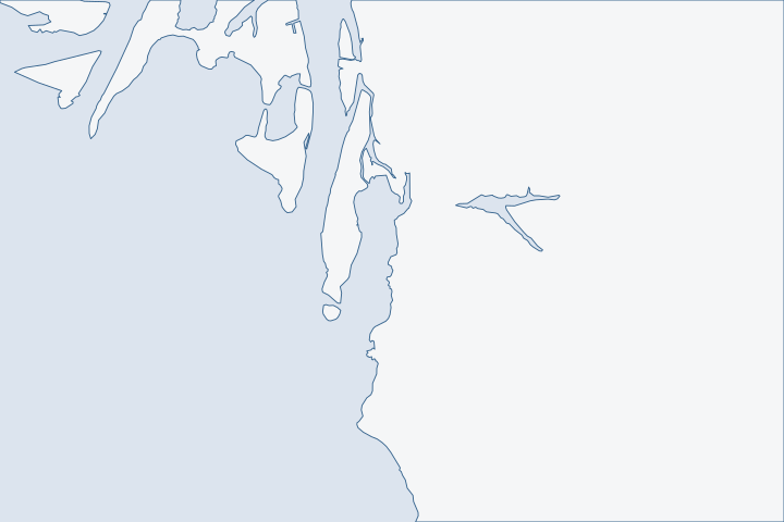
Spanish Fort, D'Olive Bay & the Causeway at a glance
- Who permits it
- City of Spanish Fort Building Department inside city limits, which run across the Causeway
- Call first
- Spanish Fort Building Department, (251) 626-4993
- The water
- D'Olive Bay, the Blakeley River and the delta north of the Causeway, upper Mobile Bay to the south
- Local rule to know
- A site disturbing 1,000 square feet or more needs a land disturbance permit before a building permit
Get to know your waterfront
Spanish Fort was incorporated on July 19, 1993. It counted 10,049 residents in 2020. The city grew from 1,542 acres to about 17,561. Its limits run west from the bluff across the whole Causeway corridor to roughly the county line, and Meaher State Park lies inside them. Named waters include the Blakeley and Apalachee rivers, Bay John, Justins Bay and Choccolatta Bay. The lower delta lies north of the road and upper Mobile Bay lies south of it.
Spanish Fort (Christopher Maloney, Auburn University; updated 2025-06-10) · TIGERweb Census 2020 layers (Incorporated Places / Census Designated Places), POP100 and HU100 fields · About Spanish Fort · TIGERweb Census Current (2026) Incorporated Places (layer 28) and Counties (layer 82), point-in-polygon and boundary queries · GNIS Domestic Names - Alabama (DomesticNames_AL.txt, file dated 2026-09-30)
Fill ground, shifting limits and a state office on the Causeway
Private bay-front lots south of the Causeway are few here. Most of this guide is about the Causeway, D'Olive Bay and the Daphne links, which carry more of the shoreline.
Which office handles which piece
Spanish Fort's limits are a patchwork of 33 pieces. A piece near the Causeway's east end, around latitude 30.655 to 30.665, belongs to Daphne. The D'Olive Bay water point, Big Island and Blakeley test outside any city, and the far west end of the road is Mobile County. Census boundary layers
| Location | Office |
|---|---|
Inside Spanish Fort | Building Department, (251) 626-4993 |
East end piece in Daphne | Daphne Building Inspection, (251) 620-1500. |
Outside both cities | Baldwin County Building Department. |
Water bottom | State Lands coastal office, 5 Rivers complex, Causeway |
The Spanish Fort Building Department is at 7361 Spanish Fort Boulevard.
The city's permit forms page lists no pier, dock or bulkhead application. City forms page Call the building department to learn how it handles one. Any site that disturbs 1,000 square feet or more needs a land disturbance permit first, with erosion and best-practice plans. City land disturbance rule
The Causeway is dredged fill
U.S. 90/98 across the bay opened in 1927. Open water and marsh were filled with dredged material for the roadbed. The road now blocks flow between the delta and the bay except at four narrow openings. ADCNR Causeway report
A 2015 state study tested sediment on both sides. It found DDT compounds, PAHs and metals above ecological benchmarks, with the most exceedances at Shellbank River. ADCNR Causeway report Before you drive piles, dredge a slip or replace a wall on a Causeway lot, ask whether sampling is needed. Fill placed in the water must be free of toxic pollutants. ADEM dredge and fill rule
- The study looked at bridge openings at Choccolatta Bay, Justins Bay and Shellbank River. A Justins Bay opening would affect about 9.4 acres of wetland. ADCNR Causeway report
- Near those sites, call State Lands before design is fixed. Its coastal office is at 31115 Five Rivers Boulevard, (251) 621-1216. ADCNR contact page
- ADEM's dredging fee is $2,125 for under 500 cubic yards. ADEM fee schedule
Storms on a low road
Georges in 1998 pushed 8.0 feet of surge above mean sea level along the Causeway and damaged many businesses. NWS Mobile Georges report Katrina destroyed or damaged most businesses there. The Mobile gauge hit 11.5 feet, near the 1916 record of 11.60. NWS Mobile Katrina report Zeta damaged restaurants on the eastern Causeway. NHC Zeta report
Debris lines in the Spanish Fort and Daphne areas stood as high as 7 feet above ground. Surveyors measured 7 to 9 feet of inundation across northeast Mobile Bay. NHC Zeta report
The bay can also empty. Isaias in October 2026 drove water in the Port of Mobile to about 3 feet below mean higher high water. NWS Mobile Isaias report Sally's back side dropped Mobile's gauge about 10.6 feet in 20 hours. NHC Sally report
- High water sets cap height and the load on tiebacks.
- Low water exposes pile toes and the face of the wall.
- Ask each designer to check both extremes.
D'Olive Bay: a young, muddy bay
D'Olive Bay sits behind a narrow peninsula slightly over a mile long that may not have formed until about 1820. That makes the bay roughly 150 years old as a separate feature. Marsh lines its low north and west sides, and uplands line the east. MBNEP D'Olive Creek page
Creeks feeding it have been the target of about $16 million in restoration work. MBNEP D'Olive program D'Olive Creek is classified for fish and wildlife up to the Lake Forest Dam. ADEM use classifications That is why the city's land disturbance rules matter on bluff and creek lots as much as the wall at the water. See Daphne and Montrose for the bluff lots.
Where barges and crews stage
Public ramps are the staging points. Chocalotta, at 3101 Battleship Parkway, has four ramps and about 50 spaces but no lights. Scott's Landing, at 5901, has one ramp with lights. The Tensaw ramp, at 1401, was listed as temporarily closed. ADCNR boating access list Meaher State Park, at 5200 Battleship Parkway East, charges $5 to launch. Alabama State Parks The D'Olive Bay ramp in Daphne has two ramps and lights. ADCNR boating access list
State and federal tests for a new or replaced wall
New bulkheads must sit at or landward of the mean high tide line. A replacement may stand at or within two feet waterward of it under a Consent of Use. State Lands rule ADEM adds that no feasible non-structural alternative can exist. ADEM coastal rule
- The Corps bank permit covers bulkheads up to 500 feet long that keep fill to an average of one cubic yard for each running foot. Corps nationwide permit 13
- Structures may use no more than a quarter of a waterbody's width and must stay 100 feet from a federal channel. State Lands rule
- Narrow delta sloughs reach those limits quickly, so measure before design.
The bay and the delta behind it
Mobile Bay is a shallow drowned river valley. It averages about 10 feet deep, runs roughly 11 miles across and 31 long and drains about 43,000 square miles. NOAA About Mobile Bay Meaher State Park covers 1,327 acres of wetland and has a 300-foot fishing pier. Alabama State Parks
Historic Blakeley State Park, on State Highway 225, protects more than 2,000 acres where Alabama's largest Civil War battle took place. It has a kayak launch. Historic Blakeley State Park Spanish Fort itself was the site of a Confederate fort attacked in 1865. Encyclopedia of Alabama
The D'Olive watershed covers about 8,739 acres shared by Daphne, Spanish Fort and the county, and its plan was updated in 2022. MBNEP D'Olive program Because three governments share it, a creek lot's drainage may cross a line. Ask each office who reviews it.
What could the work cost?
Ask bidders to price sediment questions, access by water and any land disturbance work as separate lines. Sediment testing, if the state asks for it, adds cost. Compare with costs per foot and replacement. State dredge and fill fees start at $2,655 for filling under 1,000 square feet.
Orange Beach permit values are what applicants declared for fee purposes, not invoices. Public bids carry bonding and county terms. Prices for steel, concrete, composite and aluminum come from outside Alabama and are labeled with their geography.
Compare quotes and plan a budget →Find the relevant permits and records
| Starting point | What to resolve | Prepare and look up |
|---|---|---|
City of Spanish Fort Building Department | Building and land disturbance permits inside city limits, including erosion and best-practice plans. | 7361 Spanish Fort Boulevard, (251) 626-4993, open Monday to Friday, 8 a.m. to 4:30 p.m. Ask how a bulkhead is handled, since no form is listed. |
City of Daphne or Baldwin County | The east-end piece near the Causeway, or lots outside both cities. | Daphne, (251) 620-1500. County, (251) 972-6837. |
ADCNR State Lands, Coastal Section | Use of state submerged land and early talks on Causeway restoration sites. | The office sits on the Causeway at 31115 Five Rivers Boulevard. Call (251) 621-1216. The Request to Impact fee is $100. Contact Us (Alabama Department of Conservation and Natural Resources) · Restoration of Hydrology along Upper Mobile Bay Causeway: Feasibility Investigation Report (Weston Solutions for ADCNR State Lands Division, December 2015) · ADCNR Admin. Code r. 220-4-.09 Placement and Configuration of Piers and Other Improvements on State Owned Submerged Lands |
Corps of Engineers Mobile District | Bulkhead, fill or dredge work in the bay and delta waters. | Phone (251) 690-2658. A notice is needed when fill reaches special aquatic sites. |
ADEM Coastal Program | State coastal and fill review for work in the regulated coastal zone. | Call (251) 304-1176. Ask about sediment testing early. |
A Spanish Fort and Causeway pre-bid checklist
Finish these four checks before you invite bids on a Causeway or D'Olive Bay job.
Place the lot on the jurisdiction map
Use the county parcel viewer layers. Pieces of the Causeway belong to Spanish Fort, Daphne or the county.
Permitting FAQs | Baldwin County Building Department · TIGERweb Census Current (2026) Incorporated Places (layer 28) and Counties (layer 82), point-in-polygon and boundary queries
Call the building department about marine work
No bulkhead form is listed, so ask which permit applies and whether land disturbance is triggered.
PERMIT FORMS & INFO | City of Spanish Fort · BUILDING DEPARTMENT | City of Spanish Fort
Ask State Lands about sediment and restoration sites
Walk over to the Causeway office or call. Ask whether your lot is near a studied bridge opening and whether sampling is needed.
Find the flood zone and past permits
Confirm the flood map, effective April 19, 2019, and search the county permit records for any earlier marine work on the lot.
Community Status Book Report: Alabama, Communities Participating in the National Flood Program (report date 10/31/2026) · Search Permits, Reports, Certificates of Occupancy, & Elevation Certificates | Baldwin County Building Department
Plan your Spanish Fort or Causeway project
Describe whether the lot is on the Causeway, D'Olive Bay or the bluff and what the shore does in a storm. A local marine contractor can follow up after that.
Built on Baldwin County permit rules, Alabama coastal law, public records and storm data.
Spanish Fort, D'Olive Bay & the Causeway project questions
Which city permits my Causeway bulkhead?
Mostly Spanish Fort, whose limits run across the corridor to near the county line. A piece near the east end is in Daphne, and the far west end is Mobile County.
Why does 1927 fill matter for a new wall?
The roadbed is dredged fill, and the state study found legacy contaminants in sediment on both sides of the road. Ask State Lands and ADEM whether sampling is needed before you drive piles.
Could a Causeway bridge opening affect my lot?
The state studied openings at Choccolatta Bay, Justins Bay and Shellbank River. If your lot is near one, ask State Lands what is planned.
Does Spanish Fort have a bulkhead permit form?
Its forms page lists building, land disturbance and trade permits but no pier, dock or bulkhead form. Call (251) 626-4993 to ask.
Does the state own the bottom under the Causeway waters?
Alabama owns tidal lands waterward of the mean high tide line that it has not conveyed. State Lands decides use of those bottoms.
Keep planning
Nearby waterfront guides
Show sourcesHide sources
- Spanish Fort (Christopher Maloney, Auburn University; updated 2025-06-10)Source reviewed 2026-10-31
- TIGERweb Census 2020 layers (Incorporated Places / Census Designated Places), POP100 and HU100 fieldsSource reviewed 2026-10-31
- About Spanish FortSource reviewed 2026-10-31
- TIGERweb Census Current (2026) Incorporated Places (layer 28) and Counties (layer 82), point-in-polygon and boundary queriesSource reviewed 2026-10-31
- GNIS Domestic Names - Alabama (DomesticNames_AL.txt, file dated 2026-09-30)Source reviewed 2026-10-31
- BUILDING DEPARTMENT | City of Spanish FortSource reviewed 2026-10-31
- Building InspectionSource reviewed 2026-10-31
- Permitting FAQs | Baldwin County Building DepartmentSource reviewed 2026-10-31
- Restoration of Hydrology along Upper Mobile Bay Causeway: Feasibility Investigation Report (Weston Solutions for ADCNR State Lands Division, December 2015)Source reviewed 2026-10-31
- PERMIT FORMS & INFO | City of Spanish FortSource reviewed 2026-10-31
- ADEM Admin. Code Chapter 335-8-2, rule 335-8-2-.02 Dredging and/or FillingSource reviewed 2026-10-31
- Contact Us (Alabama Department of Conservation and Natural Resources)Source reviewed 2026-10-31
- ADEM Admin. Code Chapter 335-1-6 Application Fees, adopted rule effective October 15, 2026Source reviewed 2026-10-31
- Hurricane Georges - September 28, 1998Source reviewed 2026-10-31
- Hurricane Katrina - August 2005Source reviewed 2026-10-31
- National Hurricane Center Tropical Cyclone Report: Hurricane Zeta, 24-29 October 2020Source reviewed 2026-10-31
- County Impacts Associated with Hurricane Isaias (2026)Source reviewed 2026-10-31
- National Hurricane Center Tropical Cyclone Report: Hurricane Sally, 11-17 September 2020Source reviewed 2026-10-31
- D'Olive Creek (watershed page)Source reviewed 2026-10-31
- D'Olive Watershed Restoration Program (brochure)Source reviewed 2026-10-31
- Ala. Admin. Code r. 335-6-11-.02, Use Classifications (ADEM Water Division; amendment adopted 2025-04-11, filed 2025-04-15, effective 2025-06-14)Source reviewed 2026-10-31
- Alabama Coastal Boating Access 02.2023 (KML)Source reviewed 2026-10-31
- Meaher State ParkSource reviewed 2026-10-31
- Coastal Alabama Boating AccessSource reviewed 2026-10-31
- ADCNR Admin. Code r. 220-4-.09 Placement and Configuration of Piers and Other Improvements on State Owned Submerged LandsSource reviewed 2026-10-31
- ADEM Admin. Code r. 335-8-2-.06 Shoreline Stabilization and Erosion MitigationSource reviewed 2026-10-31
- 2026 Nationwide Permit 13, Bank Stabilization, 91 FR 768Source reviewed 2026-10-31
- About Mobile Bay (WebGNOME location file documentation)Source reviewed 2026-10-31
- Historic Blakeley State ParkSource reviewed 2026-10-31
- Contact Us | Baldwin County Building DepartmentSource reviewed 2026-10-31
- South Atlantic Division > Missions > Regulatory > AlabamaSource reviewed 2026-10-31
- Alabama Coastal Area Management Program (ADEM Coastal Program page)Source reviewed 2026-10-31
- Community Status Book Report: Alabama, Communities Participating in the National Flood Program (report date 10/31/2026)Source reviewed 2026-10-31
- Search Permits, Reports, Certificates of Occupancy, & Elevation Certificates | Baldwin County Building DepartmentSource reviewed 2026-10-31