Perdido Beach and Josephine bulkhead and shoreline planning
A 36530 mailing address does not put a lot inside the Town of Perdido Beach. Most of this shore is unincorporated Baldwin County. Before you plan a bulkhead, check the old town plat, the soft shoreline and the grass beds in Soldier and Palmetto creeks.
Describe your project on this page ↓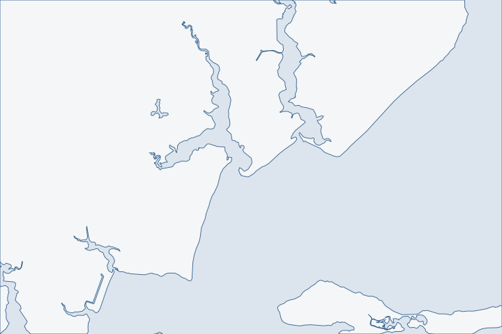
Perdido Beach & Josephine at a glance
- Who permits it
- Baldwin County Building, inside the Town of Perdido Beach and outside it
- Call first
- Town of Perdido Beach, (251) 962-2200
- The water
- West shore of middle Perdido Bay, 6 to 20 feet deep, with Soldier and Palmetto creeks
- Local rule to know
- The 1900 plat reserved beach frontage as public right-of-way
Get to know your waterfront
The west shore of middle Perdido Bay runs 6 to 20 feet deep. Soldier Creek, with a wide stretch called Crystal Lake, and Palmetto Creek drain to it. Josephine lies south of the town, along Roberts Bayou and the Intracoastal route. The Perdido Bay shoreline in the watershed plan runs about 14.7 miles from near Ross Point to the mouth of the Perdido River.
United States Coast Pilot 5, Chapter 6 (Apalachicola Bay to Mobile Bay area; pages dated 25 Oct 2026) · Historical Overview · Western Perdido Bay Watershed Management Plan (Final Draft), Table 3-4 · Gulf Frontal Watershed Management Plan, Tables 3.13 and public-access amenities table · Western Perdido Bay Watershed Management Plan (Final Draft) · GNIS Domestic Names - Alabama (DomesticNames_AL.txt, file dated 2026-09-30)
The plat, the soft shore and the permit split
Three things make this shore different from the canal communities to the south. The town covers little of it. The old plat can change your property line. And the shore is soft, lightly walled and ecologically sensitive.
The town is small and the address is misleading
The Town of Perdido Beach is one small polygon of about 3.07 square kilometers around County Road 97. The GNIS Perdido Beach point, the mouth of Soldier Creek, Palmetto Creek, the Red Bluff cliff and all of Josephine fall outside it. Census city limits The town counted 555 residents and 365 housing units in 2020. 2020 Census
Mail is no guide. ZIP area 36530 covers 247.6 square kilometers, and only 3.07 of them are inside the town. About 86 percent of the ZIP area is in no incorporated place. Census ZIP area file The town voted to incorporate on April 21, 2009, and became the county's fourteenth municipality that June. Town history
| Where the lot is | Offices involved |
|---|---|
Inside the town | Baldwin County Building issues the permit; town adds rules |
Outside the town, including Josephine | Baldwin County Building; Planning and Zoning for zoning |
Inside the town, the town adds its own zoning map, flood ordinance and right-of-way permit. Outside it, Planning and Zoning handles zoning questions.
The town hall is at 9212 County Road 97, phone (251) 962-2200. Town website FEMA's records show the town adopted the county's flood map panels in 2007. Its current effective map date is 19 April 2019. FEMA community status book Our Baldwin County hub covers the county portal and fees.
The 1900 plat can end your lot at a public strip
Colonel L.B. Hatch bought land on the west bank of Soldier Creek in December 1900 and began selling lots in 1901. His plan reserved all beach frontage except three lots as public right-of-way. That gave all 280 lots beach access. It also set aside three large lots on Palmetto Creek for marine commerce or industry. Town history
Why does that matter for a wall? A lot that looks bay-front on a map may legally stop at a public strip. Building there could mean building on land you do not own. Pull the recorded plat before anyone designs a wall or pier.
- Search the county deed records back to Book 1 in 1899. County probate office
- Look up your parcel in the county tax and appraisal search by address or parcel number. County property search
- Have a licensed surveyor mark the line between your lot and the public strip.
State Lands asks for proof of sufficient upland interest, such as a warranty deed or lease. State Lands rule If a plat strip separates you from the water, that proof may be missing.
A soft shore with few walls
The western Perdido Bay plan finds about 3.6 percent of its shoreline man-made or hardened. That is 5.60 miles of sheltered solid structures, 3.30 miles of exposed ones and 0.14 miles of riprap, out of 258.48 classified miles. Most of the rest is marsh. About 95.8 percent ranks highly sensitive. Western Perdido Bay plan ADEM classes the tidal reaches of Soldier Creek, Palmetto Creek and Spring Branch as shellfish, fish and wildlife waters. ADEM use classification
The bay's last Alabama-side seagrass sits here. Mapping in 2015 found submerged vegetation on this side of the watershed only in Palmetto Creek, Soldier Creek and a small area north of the Lillian Bridge. Western Perdido Bay plan USGS counted 114 acres of seagrass in middle Perdido Bay in 1940, mostly at the mouths of these two creeks. By 2002 only 0.7 acre remained. USGS seagrass report
ADEM will not permit a bulkhead that puts fill into submersed grassbeds unless separately authorized. ADEM bulkhead rule State Lands says riprap and similar methods should replace vertical walls wherever feasible. State Lands shoreline rule A sloped rock edge or a living shoreline is therefore often the easier request. See living shorelines and riprap.
- Soldier Creek runs 8.6 miles and Palmetto Creek 4.6 miles. Western Perdido Bay plan
- Peterson Branch runs 3.7 miles, Manuel Bayou 2.7 and Spring Branch 2.1.
A creek-edge lot sees tidal flow, boat wash and bank slumping on a small scale. A wall that suits the bay shore may be too heavy for a creek bank.
Marine business has deep roots here. The town history says Resmondo Boat Works, started in 1956, was the town's one remaining industry as of its 2012 text. Town history Ask about any commercial or shared use of the frontage before you rebuild.
Where this shore is already losing ground
The plan lists spots that erode substantially. They include Perdido Bay Park, where bluffs are falling into the bay, the Randolph Drive peninsula, Suarez Point and the Boykin Boulevard shore. They also include Clubhouse Drive in Spanish Cove, Carney Mill Drive and Bay Avenue in Perdido Beach. Aerial photos show the former roadway on Bay Avenue is now open water. Western Perdido Bay plan
Two proposals show where public money may go. One is a living shoreline of about 300 feet near Bozeman Lane, estimated at $60,000. The other is a $383,300 public access coastal protection project from ADCNR. Western Perdido Bay plan A sea-level model in the plan converts today's Perdido Beach shoreline into marsh and tidal flats under a 2.0-meter rise scenario. Western Perdido Bay plan That is a long-range scenario, not a forecast. It still argues for designs that can be raised or extended.
Josephine has two kinds of water
Roberts Bayou, known locally as Pirates Cove, empties into Arnica Bay from the north. NOAA Coast Pilot 5 Josephine Park is a public launch there, and Pirate's Cove is a private launch that charged $5. Gulf Frontal plan Josephine Park has two ramps and about 10 parking spaces. Wolf Bay plan The bayou is a sheltered cove on a busy boat route.
The open Perdido Bay shore is different. The bay averages about 7 feet deep and covers about 50 square miles, so wind has a long run across it. USGS seagrass report Match the cap height and toe design to the side you are on. For nearby coves see the Wolf Bay and Arnica Bay guide.
Storms, history and a final check
In 2020, Sally's worst damage landed on the back bays and sounds, and it reached up into Perdido Bay. Many docks and piers were destroyed. NHC Sally report The town history also notes Native American mounds found along the bay near Josephine. Town history If the Corps finds that historic properties may be affected, work cannot start until the Corps confirms review is done. 2026 Nationwide Permit conditions Mention any known site on your application.
What could the work cost?
Ask for a survey and a plat review in your first budget. If the lot touches a public strip, those costs come before any design. On this soft shore, ask for a wall price and a rock or living shoreline price side by side. Add the cost of getting equipment to a bluff or creek edge. The cost guide shows per-foot ranges.
Orange Beach permit values are what applicants declared for fee purposes, not invoices. Public bids carry bonding and county terms. Prices for steel, concrete, composite and aluminum come from outside Alabama and are labeled with their geography.
Compare quotes and plan a budget →Find the relevant permits and records
| Starting point | What to resolve | Prepare and look up |
|---|---|---|
Baldwin County Building Department | Building permit for a bulkhead, dock or lift, inside the town and outside it. | (251) 972-6837. The marine accessory flood permit needs the Corps permit and a State Lands notice. |
Town of Perdido Beach | Town zoning, flood ordinance and a permit for any work in the town right-of-way. | 9212 County Road 97, (251) 962-2200. Applies only to lots inside the town polygon. |
Baldwin County Planning and Zoning | Zoning for lots outside the town. | (251) 580-1655. Ask about land disturbance review, $25 per activity such as filling or grading. |
Alabama State Lands Division | Bottom consent and proof of upland interest. | (251) 621-1238. Bring a deed and a survey that shows mean high water. |
Corps Mobile District and ADEM Coastal Program | Federal permit and state review, with attention to grassbeds in Soldier and Palmetto creeks. | Corps (251) 690-2658. ADEM (251) 304-1176. A pier on a single-family lot is $800 at ADEM. |
Perdido Beach and Josephine pre-bid checklist
Do these steps in order. The first two decide whether you have a lot to build on.
Pull the recorded plat and deed
Use the county deed search and tax search. Look for a public strip between your lot and the water.
Recording | Baldwin County Probate Office · Baldwin County Property Tax and Appraisal Search · Historical Overview
Order a boundary survey
Ask the surveyor to mark mean high water, the plat strip and any creek bank.
ADEM Form 166, Joint Application and Notification (rev. 8/19) · Historical Overview
Confirm town or county
Use the county parcel viewer jurisdiction layers. Do not rely on the ZIP code.
Permitting FAQs | Baldwin County Building Department · 2020 ZIP Code Tabulation Area (ZCTA5) to 2020 Place Relationship File
Check for seagrass nearby
If your lot is on Soldier or Palmetto creek, ask the contractor how the design avoids grass beds.
Western Perdido Bay Watershed Management Plan (Final Draft), Section 4.6.4.1 · ADEM Admin. Code r. 335-8-2-.06 Shoreline Stabilization and Erosion Mitigation
Ask about soft options
Request a rock or living shoreline price next to the wall price.
Tell us about your Perdido Beach or Josephine shore
Name your street, the creek or bay in front of you and any change you have noticed along the edge. A local professional who knows the plat and the permit split can take it from there.
Built on Baldwin County permit rules, Alabama coastal law, public records and storm data.
Perdido Beach & Josephine project questions
I have a Perdido Beach, AL address. Am I in the town?
Probably not. The town covers about 3.07 square kilometers of a ZIP area of 247.6, and about 86 percent of the ZIP area is outside any town or city. Check the county parcel viewer.
2020 ZIP Code Tabulation Area (ZCTA5) to 2020 Place Relationship File
Who issues my bulkhead permit, the town or the county?
Baldwin County Building issues it both inside and outside the town. Lots inside the town also deal with the town's zoning and flood rules.
Building Inspection · Ordinances (and yearly ordinance pages for 2009, 2010, 2019 and 2024)
Why does the town plat matter to a seawall?
The 1900 plan reserved nearly all beach frontage as public right-of-way. A bay-front looking lot may stop at a public strip. Get the plat and a survey first.
Is a rock edge easier to permit than a vertical wall here?
Often. State Lands says riprap and similar methods should be used instead of vertical seawalls wherever feasible, and ADEM bars fill in grassbeds.
ADCNR Admin. Code r. 220-4-.09 Placement and Configuration of Piers and Other Improvements on State Owned Submerged Lands · ADEM Admin. Code r. 335-8-2-.06 Shoreline Stabilization and Erosion Mitigation
How much of this shore is walled?
The watershed plan finds about 3.6 percent man-made or hardened. Most of the rest is marsh or natural shore.
Western Perdido Bay Watershed Management Plan (Final Draft), Sections 4.7.1-4.7.2, Table 4-13
Keep planning
Nearby waterfront guides
Wolf Bay, Bear Point & Arnica Bay, Lillian, Elberta & upper Perdido Bay, Ono Island
Show sourcesHide sources
- United States Coast Pilot 5, Chapter 6 (Apalachicola Bay to Mobile Bay area; pages dated 25 Oct 2026)Source reviewed 2026-10-31
- Historical OverviewSource reviewed 2026-10-31
- Western Perdido Bay Watershed Management Plan (Final Draft), Table 3-4Source reviewed 2026-10-31
- Gulf Frontal Watershed Management Plan, Tables 3.13 and public-access amenities tableSource reviewed 2026-10-31
- GNIS Domestic Names - Alabama (DomesticNames_AL.txt, file dated 2026-09-30)Source reviewed 2026-10-31
- TIGERweb Census Current (2026) Legal and Statistical Entities, Incorporated Places layer (January 1, 2026 vintage), point-in-polygon queriesSource reviewed 2026-10-31
- TIGERweb Census 2020 layers (Incorporated Places / Census Designated Places), POP100 and HU100 fieldsSource reviewed 2026-10-31
- 2020 ZIP Code Tabulation Area (ZCTA5) to 2020 Place Relationship FileSource reviewed 2026-10-31
- Building InspectionSource reviewed 2026-10-31
- Ordinances (and yearly ordinance pages for 2009, 2010, 2019 and 2024)Source reviewed 2026-10-31
- Perdido Beach, AL | Official WebsiteSource reviewed 2026-10-31
- Community Status Book Report: Alabama, Communities Participating in the National Flood Program (report date 10/31/2026)Source reviewed 2026-10-31
- Recording | Baldwin County Probate OfficeSource reviewed 2026-10-31
- Baldwin County Property Tax and Appraisal SearchSource reviewed 2026-10-31
- ADCNR Admin. Code r. 220-4-.09 Placement and Configuration of Piers and Other Improvements on State Owned Submerged LandsSource reviewed 2026-10-31
- Ala. Admin. Code r. 335-6-11-.02, Use Classifications (ADEM Water Division; amendment adopted 2025-04-11, filed 2025-04-15, effective 2025-06-14)Source reviewed 2026-10-31
- Seagrass Status and Trends in the Northern Gulf of Mexico: 1940-2002, Perdido Bay chapter (Kirschenfeld, Turpin, Handley)Source reviewed 2026-10-31
- ADEM Admin. Code r. 335-8-2-.06 Shoreline Stabilization and Erosion MitigationSource reviewed 2026-10-31
- United States Coast Pilot 5, Chapter 12 (Intracoastal Waterway; pages dated 25 Oct 2026)Source reviewed 2026-10-31
- Wolf Bay Watershed Management Plan (web version), sections 4 and 7.3Source reviewed 2026-10-31
- National Hurricane Center Tropical Cyclone Report: Hurricane Sally, 11-17 September 2020Source reviewed 2026-10-31
- 2026 Nationwide Permit General Condition 32, Pre-Construction Notification, 91 FR 768Source reviewed 2026-10-31
- Permit Application Checklists | Baldwin County Building DepartmentSource reviewed 2026-10-31
- Contact Us | Baldwin County Building DepartmentSource reviewed 2026-10-31
- Contact Us | Baldwin County Planning & ZoningSource reviewed 2026-10-31
- Planning & Zoning Fees Schedule | Baldwin CountySource reviewed 2026-10-31
- ADEM Form 166, Joint Application and Notification (rev. 8/19)Source reviewed 2026-10-31
- Alabama Coastal Area Management Program (ADEM Coastal Program page)Source reviewed 2026-10-31
- ADEM Admin. Code Chapter 335-1-6 Application Fees, adopted rule effective October 15, 2026Source reviewed 2026-10-31
- Permitting FAQs | Baldwin County Building DepartmentSource reviewed 2026-10-31