
Weeks Bay, Fish River and Marlow bulkhead planning
A bulkhead or pier on Weeks Bay or the Fish River answers to Baldwin County, not to a city, because the shore sits outside every town. The bay is also a federal research reserve with Alabama's top water-quality label, so state and federal reviewers look hard at anything built over the water.
Describe your project on this page ↓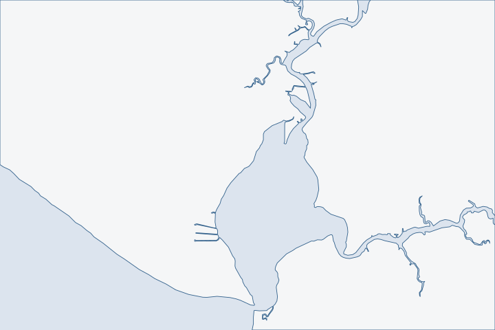
Weeks Bay, Fish River & Marlow at a glance
- Who permits it
- Baldwin County Building Department, because the shore falls outside every town and census place
- Call first
- Baldwin County Building Department, (251) 972-6837
- The water
- Weeks Bay, an Outstanding National Resource Water, 2 to 5 feet deep on average
- Local rule to know
- Weeks Bay piers under the Corps general permit stop at 300 feet and 620 square feet of deck and roof
Get to know your waterfront
Weeks Bay is a small, shallow bay of about 1,718 acres on the east side of Mobile Bay. Coast Pilot gives it an average depth of 2 to 5 feet, with a marked channel of about 4 feet leading across to the Fish River. Small boats run up the river to Marlow. Two fixed bridges limit what can follow. US 98 at Yupon has 35 feet of clearance. State Route 32 at Marlow, about 5.5 miles up, has 22 feet. The whole watershed covers about 203 square miles and touches nine towns.
Weeks Bay National Estuarine Research Reserve Management Plan 2026-2031 · United States Coast Pilot 5, Chapter 7 (Mobile Bay; pages dated 25 Oct 2026) · Weeks Bay (watershed page)
Weeks Bay rules start with the reserve
Start with the map, not the mailbox. Weeks Bay, Fish River Point, Bayside and Marlow all test outside every town and every census place. Census boundary layers Mail still scatters across three ZIP areas. Bayside uses the Foley ZIP area and Marlow uses Summerdale's, while the reserve itself has a Fairhope address. ADCNR reserve listing
Who handles what on a Weeks Bay or Fish River lot
| Work | Office and permit type |
|---|---|
Bulkhead, pier, dock or lift in a mapped flood zone | County Marine Accessory flood permit, in CitizenServe |
Same work outside a flood zone | County asks for no permit; other agencies may still |
Upland grading, filling or digging (land disturbance) | County Planning and Zoning application, $25 per activity |
Anything below mean high tide | State Lands, plus the Corps and ADEM. |
The county application must carry a Corps permit and a State Lands notice. County marine accessory permit Line those up first.
The bay's top water label tightens the review
Weeks Bay is an Outstanding National Resource Water. The reserve's plan calls that the highest water-quality designation in Alabama. Reserve management plan The reserve was set up in 1986 and covers 9,317 acres. ADCNR reserve page Its core takes in the water bottoms of the bay and of the tidal Fish and Magnolia rivers. Reserve management plan
A state rule says uses inside a research reserve that would change its natural state may not be allowed. ADEM coastal rule That is not a ban on repairs. It is a reason to phone the state coastal office before drawings are final. ADEM Coastal Program
- Corps general permit ALGP-05 holds Weeks Bay piers to 300 feet from shore, two berthing areas and 620 square feet of deck, berth and roof combined. A roof may be screened but not walled. Corps pier permit limits
- ADEM's 2026 conditions bar the quick general permits for boat slips, dredging and boat ramps on parcels that front Weeks Bay. ADEM coastal conditions
- Grass beds are mostly in the lower Fish and Magnolia rivers. Watershed plan survey A walkway over them must be uncovered, no wider than 5 feet and grated. Corps pier permit design rules
The reserve boundary may also grow. A federal notice dated October 20, 2026 asks for comment on adding 11 state-owned parcels and more state-owned water bottoms. NOAA Federal Register notice Watch it if your lot sits next to a reserve tract.
A quarter of the shore is already armored
By 2009, 3.0 miles of Weeks Bay shore had hard protection, or 26.1 percent. The Fish River had 7.3 miles, or 24.3 percent, mostly bulkheads. Watershed management plan The Magnolia River was lower at 16.5 percent. Watershed management plan Most of the rest is natural bank and marsh, which is why a new wall draws questions.
The reserve is now spending federal money, about $3.5 million, to pull out a failed bulkhead at its East Gateway Tract and bring back marsh. NOAA project list Its plan warns that bulkheaded shore weakens protection for water quality and fish. Reserve management plan
- The watershed plan sketches five living shorelines, each 200 feet long, in each of three tidal areas. Watershed management plan
- A new living shoreline under Corps permit 54 needs a notice to the Corps and a marsh or oyster component. Corps nationwide permit 54
- The Joe Faust Act halves the State Lands dredge fee for a residential owner who builds one. Alabama living shoreline law
Rock is not a cure-all here. At Pelican Point, a 2013 breakwater went in, and aerial photos show beach loss there. Eastern Shore watershed plan Ask any designer for results from nearby sites. See the living shoreline guide and riprap options.
Wakes, floods and shallow water
Heavy boat traffic on the lower Fish and Magnolia rivers may be eating small marsh islands. Photos from 1955 and 2015 show the loss. Watershed management plan Wakes also hit the toe of a wall, so ask how the design handles scour.
Nuisance floods counted by the reserve rose from 4 in 2012 to 12 in 2022. Reserve management plan NOAA's Weeks Bay gauge, station 8732828, ran from 2007 until it was pulled in April 2022. NOAA CO-OPS Its two highest readings were Nate in 2017, at 4.3 feet above mean higher high water (the average of the daily higher tides). Zeta in 2020 read 4.2 feet. NOAA CO-OPS ranking
No gauge now operates on the Baldwin shore. NOAA CO-OPS station list Ask bidders where their cap and deck heights come from.
Getting equipment to a shallow, tight shore
With about 4 feet in the channel and a 22-foot bridge at Marlow, a pile driver barge cannot go everywhere. Public launches help with staging. Marlow Ferry Park, at 16346 Honey Road, lets boats launch free at any hour. Baldwin County park listing Pelican Point, at 10201 County Road 1, has two launches and charges no fee. Baldwin County launch listing
Buying a river lot
Kidd v. Benson is a Fish River case. A bluff the sellers had stabilized collapsed months after closing and took part of the bulkhead and the boathouse into the river. The Alabama Supreme Court sided with the sellers. Alabama Supreme Court, 2020 The buyers had asked if the work was a problem, and the sellers had said it was preventive. They never had the bluff, bulkhead or boathouse inspected, and the as-is clause won. Alabama Supreme Court, 2020 Read buying a waterfront home before you sign.
Name water classes, one more layer
ADEM classes Weeks Bay for swimming and fish and wildlife, with the Outstanding National Resource Water note on the bay segment. The Magnolia River from the bay up is a higher class, Outstanding Alabama Water. ADEM use classifications The bay has held its top label since 1992, and it is one of only three in the state. Watershed management plan
That label limits point-source discharges and pushes for runoff controls on water that flows toward the bay. Reserve management plan For a shoreline job, the practical lesson is simple. Keep silt curtains, stockpile sites and wash-out areas in the plan from the first day.
Hiring and licensing on county jobs
The county asks contractors to hold an active Alabama business license. Residential work above $10,000 needs a Home Builders license, and commercial work of $100,000 or more needs a General Contractors license. County contractor rule
- An owner who does the work personally must file the county's sworn exemption statement first. County owner exemption
- That owner may not sell within a year and gives up access to the Homeowner's Recovery Fund.
- Check any bidder's license in the state board lookup. See how to verify a contractor.
What could the work cost?
Price a like-for-like wall next to a living shoreline or hybrid before you meet regulators. Ask each bidder to list barge access, toe protection and any grass-bed survey as separate lines. On the state side, a pile-supported single-family pier carries an ADEM fee of $800. See bulkhead costs per foot for Baldwin County ranges.
Orange Beach permit values are what applicants declared for fee purposes, not invoices. Public bids carry bonding and county terms. Prices for steel, concrete, composite and aluminum come from outside Alabama and are labeled with their geography.
Compare quotes and plan a budget →Find the relevant permits and records
| Starting point | What to resolve | Prepare and look up |
|---|---|---|
Baldwin County Building Department | County flood permit, Marine Accessory type, for any bulkhead, pier, dock or lift in a mapped flood zone. | Call (251) 972-6837, or visit the satellite courthouse at 1100 Fairhope Avenue. File in CitizenServe. The fee is $75, plus $15 data processing and $10 issuance. |
Baldwin County Planning and Zoning | Land disturbance for filling, grading, excavating or dredging above the water line. | Phone 251.580.1655 in Robertsdale. The fee is $25 per activity, and working without a permit doubles it. |
Corps of Engineers, Mobile District Regulatory Division | Bank stabilization under nationwide permit 13 or a Weeks Bay pier under ALGP-05. | Call (251) 690-2658. Bank work longer than 500 feet, or fill into special aquatic sites, needs a notice first. |
ADEM Coastal Program | State coastal review of armoring, piers and fill below the 10-foot contour. | 1615 South Broad Street, Mobile, (251) 304-1176. Shoreline stabilization is $1,000 for 50 feet or less with a bulkhead, and $1,665 above that. |
ADCNR State Lands Division, Coastal Section | Consent of Use for a pier or a bulkhead replaced within two feet of the old line. | Coastal Section office, Spanish Fort. Phone (251) 621-1216. A Request to Impact application costs $100. |
A Weeks Bay and Fish River pre-bid checklist
Five public-record checks to finish before you invite bids on a wall, pier or lift here.
Test the parcel against the county map
Open the Revenue Commission parcel viewer and switch on City Limits and Building Permit Jurisdictions. A lot in neither layer is a county lot.
Permitting FAQs | Baldwin County Building Department · TIGERweb Census Current (2026) Legal and Statistical Entities, Incorporated Places layer (January 1, 2026 vintage), point-in-polygon queries
Pull what the county already permitted
Permits from November 1, 2020 on are in the CitizenServe search. Older ones are in the Delta Computer Systems lookup.
Trace the deed
Search the Probate Office deed index, which runs back to 1899, for easements and boundary language along the water.
Ask reserve staff about alternatives
The reserve's Coastal Training Program teaches shoreline restoration options. Call (251) 928-9792 or stop at 11300 US 98.
Weeks Bay Visitor Center · Weeks Bay National Estuarine Research Reserve Management Plan 2026-2031
Check the flood map
The effective county flood map is dated April 19, 2019. Confirm your zone before you decide the county permit applies.
Community Status Book Report: Alabama, Communities Participating in the National Flood Program (report date 10/31/2026) · Permit Application Checklists | Baldwin County Building Department
Plan your Weeks Bay or Fish River project
Tell us the reach of river or bay, what the wall or pier is doing and whether the lot is near a reserve tract. A local marine contractor who works the river can follow up once we have those details.
Built on Baldwin County permit rules, Alabama coastal law, public records and storm data.
Weeks Bay, Fish River & Marlow project questions
Does a city permit a bulkhead on Weeks Bay or Fish River?
No. Weeks Bay, Fish River Point, Bayside and Marlow all fall outside every town, so Baldwin County is the local office. State Lands and the Corps review work over the water on top of that.
TIGERweb Census Current (2026) Legal and Statistical Entities, Incorporated Places layer (January 1, 2026 vintage), point-in-polygon queries · Permitting FAQs | Baldwin County Building Department
How long a pier can I build on Weeks Bay?
The Corps general permit stops piers at 300 feet from shore, with two berthing areas and 620 square feet of terminal deck and roof. Ask the Corps which review applies beyond those limits.
ALGP-05 Piers and Pile-Supported Structures, special conditions SP-11 to SP-13
Will the reserve status stop me from replacing a failed wall?
Not by itself. ADEM says uses that would change a reserve's natural state may not be allowed, so the state looks harder here. Ask the coastal office before you finalize design, and be ready to show why a non-structural option will not work.
ADEM Admin. Code Chapter 335-8-1, rule 335-8-1-.04 Special Management Areas · ADEM Admin. Code r. 335-8-2-.06 Shoreline Stabilization and Erosion Mitigation
Does flood insurance pay for a damaged bulkhead?
Generally no. The standard federal flood policy excludes seawalls, bulkheads, piers and docks from covered property. Check your own policy form and see seawall insurance.
44 CFR Part 61, Appendix A(1), Standard Flood Insurance Policy, Dwelling Form
Can I buy a Fish River house as-is and sue over the bulkhead later?
That path failed in Kidd v. Benson. Buyers who sign an as-is contract and skip an inspection could not use any exception to caveat emptor. Have the wall inspected before closing.
Kidd v. Benson, Supreme Court of Alabama, No. 1190413 (released September 4, 2020)
Keep planning
Nearby waterfront guides
Magnolia Springs & the Magnolia River, Point Clear, Battles Wharf & Mullet Point, Bon Secour & the Bon Secour River
Show sourcesHide sources
- Weeks Bay National Estuarine Research Reserve Management Plan 2026-2031Source reviewed 2026-10-31
- United States Coast Pilot 5, Chapter 7 (Mobile Bay; pages dated 25 Oct 2026)Source reviewed 2026-10-31
- Weeks Bay (watershed page)Source reviewed 2026-10-31
- TIGERweb Census Current (2026) Legal and Statistical Entities, Incorporated Places layer (January 1, 2026 vintage), point-in-polygon queriesSource reviewed 2026-10-31
- Weeks Bay Visitor CenterSource reviewed 2026-10-31
- Permit Application Checklists | Baldwin County Building DepartmentSource reviewed 2026-10-31
- Planning & Zoning Fees Schedule | Baldwin CountySource reviewed 2026-10-31
- ADCNR Admin. Code Chapter 220-4 (State Lands Division), r. 220-4-.09 Placement and Configuration of Piers and Other Improvements on State Owned Submerged LandsSource reviewed 2026-10-31
- Weeks Bay ReserveSource reviewed 2026-10-31
- ADEM Admin. Code Chapter 335-8-1, rule 335-8-1-.04 Special Management AreasSource reviewed 2026-10-31
- Alabama Coastal Area Management Program (ADEM Coastal Program page)Source reviewed 2026-10-31
- ALGP-05 Piers and Pile-Supported Structures, special conditions SP-11 to SP-13Source reviewed 2026-10-31
- Weeks Bay Watershed Management Plan (Thompson Engineering for the Mobile Bay National Estuary Program)Source reviewed 2026-10-31
- Draft Revised Management Plans for the ACE Basin, Elkhorn Slough, and Weeks Bay National Estuarine Research Reserves; Notice of Proposed Boundary Changes (FR Doc. 2026-21418)Source reviewed 2026-10-31
- Shoreline Restoration to Enhance Coastal Resilience within the Weeks Bay National Estuarine Research ReserveSource reviewed 2026-10-31
- 2026 Nationwide Permit 54, Living Shorelines, 91 FR 768Source reviewed 2026-10-31
- Code of Alabama 1975 Sec. 9-7-13.1, Dredging of Material for Use in Constructing a Residential Living ShorelineSource reviewed 2026-10-31
- Eastern Shore Watershed Management Plan (final, August 16, 2023)Source reviewed 2026-10-31
- CO-OPS station metadata: 8732828 Weeks Bay, Mobile Bay, ALSource reviewed 2026-10-31
- CO-OPS Top Ten Water Levels: 8732828 Weeks Bay, Mobile Bay, ALSource reviewed 2026-10-31
- CO-OPS Metadata API: water level stationsSource reviewed 2026-10-31
- Hurricane Danny - July 1997Source reviewed 2026-10-31
- West Boat LaunchesSource reviewed 2026-10-31
- Kidd v. Benson, Supreme Court of Alabama, No. 1190413 (released September 4, 2020)Source reviewed 2026-10-31
- Ala. Admin. Code r. 335-6-11-.02, Use Classifications (ADEM Water Division; amendment adopted 2025-04-11, filed 2025-04-15, effective 2025-06-14)Source reviewed 2026-10-31
- Permitting FAQs | Baldwin County Building DepartmentSource reviewed 2026-10-31
- Contact Us | Baldwin County Building DepartmentSource reviewed 2026-10-31
- Baldwin County Building Inspection Department Fee Schedule (effective 10/01/2023, updated 10/01/2024)Source reviewed 2026-10-31
- Contact Us | Baldwin County Planning & ZoningSource reviewed 2026-10-31
- South Atlantic Division > Missions > Regulatory > AlabamaSource reviewed 2026-10-31
- ADEM Admin. Code Chapter 335-1-6 Application Fees, adopted rule effective October 15, 2026Source reviewed 2026-10-31
- Contact Us (Alabama Department of Conservation and Natural Resources)Source reviewed 2026-10-31
- Search Permits, Reports, Certificates of Occupancy, & Elevation Certificates | Baldwin County Building DepartmentSource reviewed 2026-10-31
- Recording | Baldwin County Probate OfficeSource reviewed 2026-10-31
- Community Status Book Report: Alabama, Communities Participating in the National Flood Program (report date 10/31/2026)Source reviewed 2026-10-31
- ADEM Admin. Code r. 335-8-2-.06 Shoreline Stabilization and Erosion MitigationSource reviewed 2026-10-31
- 44 CFR Part 61, Appendix A(1), Standard Flood Insurance Policy, Dwelling FormSource reviewed 2026-10-31