
Point Clear, Battles Wharf and Mullet Point shoreline planning
A Point Clear bulkhead is permitted by Baldwin County, even though the mailing address says Fairhope. None of the Point Clear census area lies inside the City of Fairhope. The bigger planning question is how tightly this shore is already armored, and how your wall meets the neighbors'.
Describe your project on this page ↓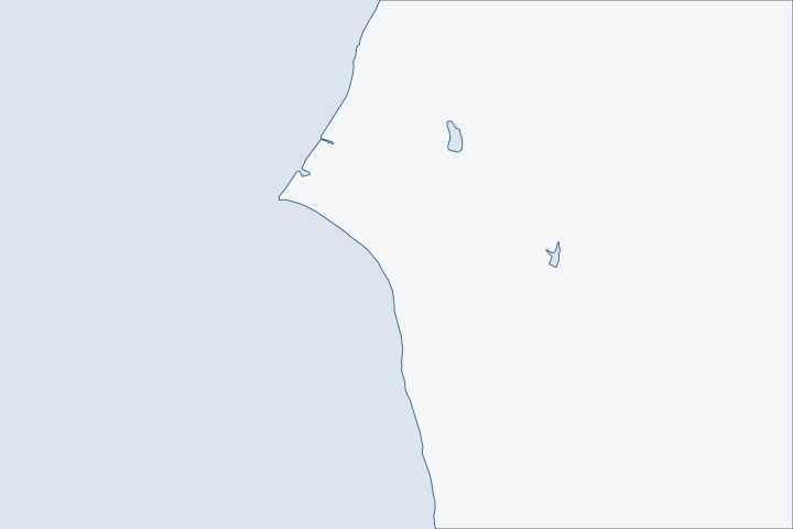
Point Clear, Battles Wharf & Mullet Point at a glance
- Who permits it
- Baldwin County Building Inspection, not the City of Fairhope
- Call first
- Baldwin County Building Inspection, (251) 972-6837
- The water
- Open Mobile Bay east shore, with shoals running west from Great Point Clear
- Local rule to know
- A replacement bulkhead may stand on the mean high tide line or up to two feet waterward of it
Get to know your waterfront
Point Clear sits on the east side of Mobile Bay, about 16 miles above the entrance. A light marks shoals that run west from Great Point Clear, and a privately dredged channel, reported at 5.5 feet in 1999, leads to a yacht harbor. The Point Clear census area counted 2,076 residents in 2020. Battles Wharf and Loyola Villa fall inside it. Mullet Point and Barnwell fall outside it.
United States Coast Pilot 5, Chapter 7 (Mobile Bay; pages dated 25 Oct 2026) · TIGERweb Census 2020 layers (Incorporated Places / Census Designated Places), POP100 and HU100 fields · TIGERweb Census Current (2026) Incorporated Places and Census Designated Places layers
A heavily walled shore, a county permit, and shared lines
The short answer is the county, not Fairhope. The city's bay-front limits begin north of about latitude 30.512, and Point Clear lies south of that. Census boundary layers Baldwin County's building jurisdiction covers unincorporated land. County permit jurisdiction
Why the mail says Fairhope
One ZIP area, 36532, covers 189.5 square kilometers. About 36.7 of them are in Fairhope, 11.6 are in the Point Clear census area and 141.2 are in no place at all. Census ZIP area file A ZIP code tells you nothing about who permits the wall. Check the parcel instead.
| Work | Office |
|---|---|
Bulkhead, pier or lift in a flood zone | County Marine Accessory flood permit, via CitizenServe |
Same work outside a flood zone | No county permit; other agencies may require one |
Mullet Point and Barnwell lots | Also county |
Mullet Point and Barnwell are handled by the county because both test outside the census area and every town.
One of the most armored stretches of the bay
The estuary program says 65 percent of the Eastern Shore's tidal shoreline is man-made protection. Eastern Shore watershed plan Two creek basins show it.
| Basin | Shoreline | Bulkhead or seawall | Natural |
|---|---|---|---|
Point Clear Creek | 4.2 miles | 62% | 24% |
Bailey Creek | 3.8 miles | 91% | not reported |
With walls this continuous, a failing section almost always ties into a neighbor's wall at each end. Agree on returns, tie-ins and end scour with the neighbors before you order sheet pile. A hard wall also reflects wave energy onto its neighbors. Alabama shoreline manual
The Grand Hotel area shows how this shore got this way. Photos from 1954 already show bulkheads and pocket beaches, and later work added jetties and a bigger dug marina. Eastern Shore watershed plan The hotel's own record lists hurricane damage in 1893, 1906 and 1916, then Frederic in 1979, Ivan in 2004 and Katrina in 2005. Encyclopedia of Alabama
Piers: the part that storms take first
Coast Pilot warns that many old landings along the east shore are in ruins and dangerous to small boats close inshore. NOAA Coast Pilot 5 The estuary program wants dilapidated piers inventoried and the bay's stormwater outfalls checked again, since the last study predates Sally. Eastern Shore watershed plan
- Hurricane Nate in 2017 damaged just under 200 piers in the county, 62 of them badly. The surge ran highest on the Eastern Shore. NWS Mobile Nate report
- Zeta's surge in 2020 reached south to Point Clear and crossed County Road 1. Several Eastern Shore piers were destroyed. NHC Zeta report
- Rebuilding more than half of a pier, or changing its pilings, brings it under State Lands review. State Lands rule
- A pier must sit at least 10 feet inside your riparian lines, unless a neighbor signs a letter. State Lands rule
Budget pier repair as a recurring cost. Pull any dead pilings when you rebuild. See docks and boat lifts for the permit path.
The two-foot rule on replacement
When an old wall is replaced, State Lands allows a Consent of Use under one condition. The new wall must stand on the mean high tide line or up to two feet out from it. New walls must sit at or landward of that line. State Lands rule On a shore this built up, that two feet is the margin you have. Hire a surveyor to mark mean high water before the design is drawn.
ADEM adds its own tests. The wall must stand no lower than mean high tide, and the agency must see no workable non-structural option. ADEM coastal rule If a storm broke the wall, the Corps repair permit covers the job when it begins, or is contracted, inside two years. Corps nationwide permit 3
Surge, jubilees and the work calendar
Katrina's surge topped 13 feet above the NAVD88 datum north of Fairhope. It then fell sharply to the south, to as low as 5 feet at the east end of Bon Secour Bay. FEMA Katrina study Point Clear lies in the zone where those readings fall off.
Jubilees are the local calendar item. They have been seen since at least 1821, mostly before dawn in August, and run most often from Point Clear to Daphne. Eastern Shore watershed plan Keep stockpiles and debris off the beach in that season. The plan lists public bay access points along Scenic 98 and County Road 1. Eastern Shore watershed plan For barge staging, Mullet Point Park at 13153 County Road 1 has a launch with lighted parking and no launch fee. Baldwin County park listing
When the bay empties
Wind decides water level on Mobile Bay as much as tide does. The great diurnal range (the gap between the lowest low and highest high of a day) is only 1.5 feet at the Point Clear tide station, 8733821. NOAA tide stations Storm wind moves far more water than that.
In 1997, Danny blew water out of the bay until the Mobile gauge read a low of minus 2 feet. Observers said they had never seen it so low. NWS Mobile Danny report Sally's back side dropped some gauges below their instruments' limits. NHC Sally report
- Low water shows how deep the pile toes really are.
- High water sets the cap height and tests the tiebacks.
- Frederic in 1979 brought 8 to 10 feet of surge to northern Mobile Bay. NWS Mobile Frederic report
Mobile's long-run sea level trend is 1.8 inches per decade. NOAA sea level trends Ask designers what margin they add above the old cap.
Mullet Point, where Bon Secour Bay begins
ADEM's Bon Secour Bay segment starts at a line from Mullet Point across to Fort Morgan, and it carries the shellfish-harvesting class. ADEM use classifications Point Clear Creek itself is classed for fish and wildlife. ADEM use classifications
The state lists a Mullet Point ramp with one lane, lights, a courtesy dock and about 25 parking spots, and notes the state does not maintain it. ADCNR boating access list Check the ramp's condition before you plan a barge launch there.
Hiring on a county job
Baldwin County wants every contractor in its jurisdiction to hold an Alabama business license. It also checks that the license fits the scope, with a Home Builders license above $10,000 of residential work. County contractor rule Use the state board's online search. Home Builders Licensure Board See verify a contractor.
What could the work cost?
Ask bidders to price tie-ins and returns at each property line as separate items, since walls here connect to the neighbors'. Add derelict piling removal to any pier quote. The state's fee schedule lists $800 for a pier serving one home. Sort the rest with repair or replace and costs per foot.
Orange Beach permit values are what applicants declared for fee purposes, not invoices. Public bids carry bonding and county terms. Prices for steel, concrete, composite and aluminum come from outside Alabama and are labeled with their geography.
Compare quotes and plan a budget →Find the relevant permits and records
| Starting point | What to resolve | Prepare and look up |
|---|---|---|
Baldwin County Building Inspection | Flood permit with the Marine Accessory sub-type for bulkheads, piers, boathouses and lifts in a flood zone. | Call (251) 972-6837. Fairhope's satellite courthouse is at 1100 Fairhope Avenue. County fees are $75, $15 and $10 as listed. |
Baldwin County Planning and Zoning | Zoned land disturbance when soil is graded or filled behind the wall. | Phone 251.580.1655. The fee is $25 per activity. |
State Lands Division, Coastal Section | State permission to use the bottom for a pier, or for a replacement wall set close to the old line. | Five Rivers Boulevard office in Spanish Fort, phone (251) 621-1216. The application is $100. |
Corps of Engineers Mobile District | Nationwide permit 13 for a bulkhead, or permit 3 to repair a storm-damaged one. | Phone (251) 690-2658. After a complete notice, work may start on written approval or after 45 days of silence, unless listed species are involved. |
ADEM Coastal Program | State coastal review of work in the regulated coastal zone. | Phone (251) 304-1176. Stabilization costs $1,000 up to 50 feet of wall and $1,665 past that. |
Point Clear records to pull before you ask for bids
These four checks use public records and take an afternoon.
Confirm you are outside Fairhope
Use the county parcel viewer's City Limits layer. Fairhope's limits are patchy, so do not trust the ZIP code.
Permitting FAQs | Baldwin County Building Department · TIGERweb Census Current (2026) Incorporated Places and Census Designated Places layers
Search county permits on your street
Look up bulkhead and pier permits for neighbors in CitizenServe, and in the older Delta lookup for work before November 2020.
Ask the county for older files
If a record is missing, email the address to the permitting office or file an online public records request.
Mark mean high water
Have a licensed Alabama surveyor show the mean high water line on a survey, since the two-foot replacement rule is measured from it.
ADCNR Admin. Code r. 220-4-.09 Placement and Configuration of Piers and Other Improvements on State Owned Submerged Lands · Living Shorelines: A Permitting Guide for Alabama Homeowners (Publication 3120, MASGC-17-068)
Plan your Point Clear shoreline project
Tell us whether you are at Point Clear, Battles Wharf or Mullet Point. Tell us what shape the wall and pier are in, and who owns the walls on each side. Once we have those details, a local professional can follow up.
Built on Baldwin County permit rules, Alabama coastal law, public records and storm data.
Point Clear, Battles Wharf & Mullet Point project questions
Is Point Clear part of Fairhope for permit purposes?
No. The Point Clear census area sits south of Fairhope's bay-front limits, so the county is the building office even though the ZIP area matches downtown Fairhope.
TIGERweb Census Current (2026) Incorporated Places and Census Designated Places layers · 2020 ZIP Code Tabulation Area (ZCTA5) to 2020 Place Relationship File
Does the county need a permit for my bulkhead?
The county requires a marine accessory permit when the work is in a mapped flood hazard area. Outside one, it asks for none, though state and federal agencies still may.
Permit Application Checklists | Baldwin County Building Department
How far out can I set a replacement bulkhead?
Under a Consent of Use, the new wall may sit on the old line or up to two feet out from mean high tide. Going farther out needs more review.
My wall was damaged by a storm. Is there a deadline for repair?
The Corps repair permit covers storm damage when the job begins or is contracted inside two years. After a hurricane, the district may waive that limit if funding or contract delays are shown.
Do jubilees limit when work can happen?
Nothing in the records sets a work ban. Jubilees are most common before dawn in August from Point Clear to Daphne, so plan to keep debris and stockpiles off the shore then.
Eastern Shore Watershed Management Plan (final, August 16, 2023)
Keep planning
Nearby waterfront guides
Fairhope bayfront & Fly Creek, Weeks Bay, Fish River & Marlow, Bon Secour & the Bon Secour River
Show sourcesHide sources
- United States Coast Pilot 5, Chapter 7 (Mobile Bay; pages dated 25 Oct 2026)Source reviewed 2026-10-31
- TIGERweb Census 2020 layers (Incorporated Places / Census Designated Places), POP100 and HU100 fieldsSource reviewed 2026-10-31
- TIGERweb Census Current (2026) Incorporated Places and Census Designated Places layersSource reviewed 2026-10-31
- Permitting FAQs | Baldwin County Building DepartmentSource reviewed 2026-10-31
- 2020 ZIP Code Tabulation Area (ZCTA5) to 2020 Place Relationship FileSource reviewed 2026-10-31
- Permit Application Checklists | Baldwin County Building DepartmentSource reviewed 2026-10-31
- TIGERweb Census Current (2026) Legal and Statistical Entities, Incorporated Places layer (January 1, 2026 vintage), point-in-polygon queriesSource reviewed 2026-10-31
- Eastern Shore Watershed Management Plan (final, August 16, 2023)Source reviewed 2026-10-31
- Coastal Alabama Living Shorelines Policies, Rules, and Model Ordinance Manual (Boyd and Pace; supported by the Mobile Bay National Estuary Program)Source reviewed 2026-10-31
- Grand Hotel Golf Resort and SpaSource reviewed 2026-10-31
- Hurricane Nate - October 7-8, 2017Source reviewed 2026-10-31
- National Hurricane Center Tropical Cyclone Report: Hurricane Zeta, 24-29 October 2020Source reviewed 2026-10-31
- ADCNR Admin. Code r. 220-4-.09 Placement and Configuration of Piers and Other Improvements on State Owned Submerged LandsSource reviewed 2026-10-31
- ADEM Admin. Code r. 335-8-2-.06 Shoreline Stabilization and Erosion MitigationSource reviewed 2026-10-31
- 2026 Nationwide Permit 3, Maintenance, 91 FR 768Source reviewed 2026-10-31
- High Water Mark Collection for Hurricane Katrina in Alabama, FEMA-1605-DR-AL, Final Report (URS Group for FEMA)Source reviewed 2026-10-31
- Mullet Point ParkSource reviewed 2026-10-31
- CO-OPS datums: 8733821 Point Clear, 8733502 Fly Creek, 8733839 Meaher State Park, 8732828 Weeks BaySource reviewed 2026-10-31
- Hurricane Danny - July 1997Source reviewed 2026-10-31
- National Hurricane Center Tropical Cyclone Report: Hurricane Sally, 11-17 September 2020Source reviewed 2026-10-31
- Hurricane Frederic - September 12, 1979Source reviewed 2026-10-31
- CO-OPS Sea Level Trends (derived product API)Source reviewed 2026-10-31
- Ala. Admin. Code r. 335-6-11-.02, Use Classifications (ADEM Water Division; amendment adopted 2025-04-11, filed 2025-04-15, effective 2025-06-14)Source reviewed 2026-10-31
- Coastal Alabama Boating AccessSource reviewed 2026-10-31
- Contact Us (Alabama Home Builders Licensure Board)Source reviewed 2026-10-31
- Contact Us | Baldwin County Building DepartmentSource reviewed 2026-10-31
- Baldwin County Building Inspection Department Fee Schedule (effective 10/01/2023, updated 10/01/2024)Source reviewed 2026-10-31
- Contact Us | Baldwin County Planning & ZoningSource reviewed 2026-10-31
- Planning & Zoning Fees Schedule | Baldwin CountySource reviewed 2026-10-31
- Contact Us (Alabama Department of Conservation and Natural Resources)Source reviewed 2026-10-31
- South Atlantic Division > Missions > Regulatory > AlabamaSource reviewed 2026-10-31
- Alabama Coastal Area Management Program (ADEM Coastal Program page)Source reviewed 2026-10-31
- ADEM Admin. Code Chapter 335-1-6 Application Fees, adopted rule effective October 15, 2026Source reviewed 2026-10-31
- Search Permits, Reports, Certificates of Occupancy, & Elevation Certificates | Baldwin County Building DepartmentSource reviewed 2026-10-31
- Living Shorelines: A Permitting Guide for Alabama Homeowners (Publication 3120, MASGC-17-068)Source reviewed 2026-10-31