Wolf Bay, Bear Point and Arnica Bay bulkhead planning
Three governments share Wolf Bay: the City of Orange Beach, unincorporated Baldwin County and the Town of Elberta. Your permit office depends on exactly where the lot sits. The bay's special water class and mostly natural shore also shape what reviewers will approve.
Describe your project on this page ↓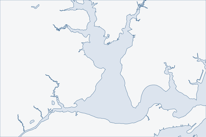
Wolf Bay, Bear Point & Arnica Bay at a glance
- Who permits it
- Orange Beach near Bear Point, Baldwin County at Arnica Bay, and Elberta at Peterson Point
- Call first
- Orange Beach Community Development, (251) 981-2610
- The water
- Wolf Bay, an Outstanding Alabama Water since April 2007
- Local rule to know
- Reviewers require non-structural options to be ruled out before armoring
Get to know your waterfront
The Intracoastal Waterway runs through Arnica Bay, Bay La Launch and Wolf Bay, from Mile 166.8E to Mile 160.0E. This shore meets both barge traffic and open fetch (long stretches of open water). Arnica Bay and Bay La Launch link Perdido Bay on the east with Wolf Bay on the west. Roberts Bayou, locally called Pirates Cove, opens off the north side of Arnica Bay.
United States Coast Pilot 5, Chapter 12 (Intracoastal Waterway; pages dated 25 Oct 2026) · U.S. Coast Pilot 5, Chapter 6 (edition dated 25 Oct 2026), paragraph 353 · GNIS Domestic Names - Alabama (DomesticNames_AL.txt, file dated 2026-09-30)
Three jurisdictions, one special water and a mostly natural shore
Start with the map. The city line runs through the middle of this area, and the permit office changes when you cross it.
Where the lines fall
Census boundary layers place Bear Point inside Orange Beach. The city limit runs north along the east side of Wolf Bay to about latitude 30.34. Points at Arnica Bay, Roberts Bayou, Ross Point, Josephine, Sapling Point, Mulberry Point, Hammock Bay and Graham Bayou fall in no incorporated place. Peterson Point at the head of the bay is inside the Town of Elberta. Census city limits
| Part of the bay | Building permit office |
|---|---|
Bear Point, east Wolf Bay to about 30.34 north | City of Orange Beach. |
Arnica Bay, Roberts Bayou, Sapling and Mulberry points | Baldwin County Building Inspection. |
Peterson Point, head of the bay | County building permit, plus the town's Land Use Certificate. |
Elberta's planning office handles only lots inside town limits, at (251) 986-5995 extension 4. Elberta Planning Department For the town side of the shore, see the Lillian and Elberta guide. Our Baldwin County hub explains the county permit portal.
An Outstanding Alabama Water
ADEM lists Wolf Bay and its connecting coves and bayous, from the Intracoastal Waterway to Moccasin Bayou, as an Outstanding Alabama Water. ADEM use classification It was designated in April 2007 and was the first bay in the state to earn the class. Mobile Bay National Estuary Program The class brings stricter limits on wastewater and toxic discharges, a higher minimum dissolved oxygen level and lower allowed pathogen levels. Wolf Bay water class summary
The class is about water quality, not a ban on walls. Still, ask your contractor how muddy water and runoff from the job will be controlled. Arnica Bay and Bay La Launch carry a different class, which is shellfish, swimming and fish and wildlife. ADEM use classification
Most of the shore is still natural
A field survey of about 63,190 feet of Wolf Bay shoreline counted 52,127 feet as natural. Steel or wood bulkhead made up 8,103 feet, rubble and riprap 1,841 feet, and concrete bulkhead 210 feet. Wolf Bay survey A state table shows the open bay mapped at 0% armoring in 2011, with Bay La Launch and South Wolf Bay at 18.9%. Lighter armoring table
- Arnica Bay is the exception. It stood at 56% hard armoring in 2012. Alabama armoring table
- The north shore is going the other way. Alabama's Forever Wild program bought a 568-acre tract in July 2017. Wolf Bay watershed plan
- The City of Foley received a $4,000,000 award in 2025 to buy 470 acres of pine savanna and marsh on the bay. NOAA award listing
What does that mean for a new wall? ADEM asks an applicant to rule out preservation, restoration and retreat before armoring. ADEM bulkhead rule On a stretch of natural shore, a new vertical wall will draw more questions than a replacement in the old footprint. A living shoreline may be the easier path. The estuary program for Perdido Bay offers design guidance, permitting help and financial assistance for living shorelines. Escambia County news release
Arnica Bay and the Intracoastal lots
Lots that face the Intracoastal channel take boat and barge wake on top of north-wind chop. Tide range is tiny here. Arnica Bay's great diurnal range is 0.8 foot and Wolf Bay's is 0.9 foot. NOAA station datums Waves and wake, not tide, do the work.
The channel also sets pier limits. The Corps regional permit for piers keeps structures 100 feet from a federal navigation channel unless waived. Alabama General Permit 05 State Lands also keeps structures 100 feet from a federal channel and under 25 percent of the waterway width. State Lands rule Coast Pilot lists a submerged wreck at Mile 165.9E. It also lists a marina basin at Mile 165.1E with 8 feet reported alongside in 2012. Coast Pilot 5 Coast Pilot 5
Wolf Bay water also moves with the wind. Its tributary creeks swing up to about two feet daily, and the Intracoastal flow toward Perdido Bay or Mobile Bay depends on wind and tide. Wolf Bay plan See cap and panel repair for wall damage from repeated wake.
What the existing walls are made of
The shoreline survey sorts the hardened edge by material. Steel or wood bulkhead is by far the most common. Smaller amounts are concrete bulkhead, bulkhead backed with riprap, and 51 feet of creosote bulkhead. Wolf Bay survey A city permit in September 2024 shows a typical add-on: stone riprap placed to the Corps permit's specifications on a $10,000 job. City monthly permit report Our riprap page explains when rock helps.
Old timber and steel walls fail in different ways. Timber rots at the waterline and at the tie rods. Steel corrodes where the coating wears off. Ask an inspector which one you have, because the fix is not the same. Read repair or replace before you decide.
Property lines run out into the water
On a bay this irregular, neighbors' water frontages can overlap. State Lands says a binding riparian boundary can be set only by agreement of the owners or by a court. Accepting a survey does not stop it from later requiring a structure to move. State Lands rule The same rules require proof that you control the upland, such as a deed or association papers. State Lands rule
- Get a written note from the next-door owner if your dock or return wall comes close to the line.
- Pull your deed from the county's deed search so the surveyor starts from the record. County probate office
What the storms did
In Ivan in September 2004, an unofficial gust of 126 knots was reported from a sailboat anchored in Wolf Bay. NHC Ivan report Sally in 2020 hit hardest in the sheltered bays and sounds, including the Perdido Bay side. NHC Sally report FEMA records list a $677,419 city project at Waterfront Park after Sally. FEMA Public Assistance records
Public access is thin, so use what exists
The old Wolf Bay Lodge launch is permanently closed and neighborhood ramps are private. The nearest public ramps are Josephine Park with two ramps and Canal Park in Gulf Shores. Wolf Bay plan The city's canoe trail has 12 designated sites on Wolf Bay, Bay La Launch, Arnica Bay, Bayou St. John and Cotton Bayou. City canoe trail page Waterfront Park is at 26425 Canal Road. City canoe trail page A paddle past your own shore shows toe scour and failed caps from the water side.
What could the work cost?
On a natural shore, ask for two prices: a vertical wall and a softer option such as riprap or a living shoreline. Ask each bidder to separate runoff controls and any barge access from the wall cost. State fees are modest, so most of the spread comes from design and access. Use the cost guide to check per-foot ranges.
Orange Beach permit values are what applicants declared for fee purposes, not invoices. Public bids carry bonding and county terms. Prices for steel, concrete, composite and aluminum come from outside Alabama and are labeled with their geography.
Compare quotes and plan a budget →Find the relevant permits and records
| Starting point | What to resolve | Prepare and look up |
|---|---|---|
City of Orange Beach | Site Permit for a bulkhead and a separate Building Permit for any pier, on lots inside city limits near Bear Point. | Community Development, (251) 981-2610. Bulkhead permit is $50 for homes and $100 for commercial or multi-family. |
Baldwin County Building Department | Marine accessory flood permit for Arnica Bay, Roberts Bayou, Josephine and similar unincorporated lots, and for Elberta lots. | (251) 972-6837. The county permits the building side for the Town of Elberta too. |
Town of Elberta Planning Department | Land Use Certificate for lots inside town limits at the head of Wolf Bay. | 13052 Main Street, (251) 986-5995 extension 4. It does not handle lots outside the town. |
Alabama State Lands Division | Bottom consent, with a 25 percent waterway width cap and a 100-foot distance from a federal channel. | (251) 621-1238. Docks sit at least 10 feet inside riparian lines, though walls have an exception. |
ADEM Coastal Program and the Corps Mobile District | State coastal review and federal permit for shoreline work. | ADEM (251) 304-1176. Corps (251) 690-2658. Joint application Form 166 serves both. |
Wolf Bay pre-bid checklist
Do these four checks with public records before you ask for bids.
Find which side of the line you are on
Use the county parcel viewer layers. Bear Point lots may be city lots, while Arnica Bay and Roberts Bayou lots may be county lots.
Permitting FAQs | Baldwin County Building Department · TIGERweb Census Current (2026) Legal and Statistical Entities, Incorporated Places layer (January 1, 2026 vintage), point-in-polygon queries
Count what is already built on your block
Compare your shoreline with the survey. If neighbors are natural, expect more questions about a new wall.
Wolf Bay Watershed Management Plan (Volkert, Inc. and Allen Engineering and Science for the Mobile Bay National Estuary Program) · Coastal Alabama Living Shorelines Policies, Rules, and Model Ordinance Manual (Boyd and Pace; supported by the Mobile Bay National Estuary Program)
Check your distance from the Intracoastal channel
A long pier near the channel may hit the 100-foot rule. Ask the contractor to scale it on the drawing.
ALGP-05 Piers and Pile-Supported Structures (SAM-2025-00970-LHL), 2026 Alabama General Permit Program · ADCNR Admin. Code r. 220-4-.09 Placement and Configuration of Piers and Other Improvements on State Owned Submerged Lands
Walk the public side
Visit Josephine Park or a canoe trail site and look at your own wall from the water.
Wolf Bay Watershed Management Plan (web version), sections 4 and 7.3 · Canoe Trail
Tell us about your Wolf Bay or Arnica Bay wall
Send your street, your part of the bay and the damage you notice. A local marine contractor familiar with Wolf Bay's rules can follow up, and we will help you shape the request.
Built on Baldwin County permit rules, Alabama coastal law, public records and storm data.
Wolf Bay, Bear Point & Arnica Bay project questions
Does Orange Beach permit my Wolf Bay wall?
Only if the lot is inside city limits. Bear Point and the east side of the bay up to about latitude 30.34 are city. Most other points on the bay are in the county.
What does Outstanding Alabama Water mean for a bulkhead?
It is a water quality class. It brings stricter limits on discharges and a higher dissolved oxygen minimum. Ask how job runoff will be controlled.
Can I put a new wall on a natural shoreline?
You can apply, but ADEM requires you to rule out non-structural options first. A replacement in the old footprint or a living shoreline is easier to defend.
ADEM Admin. Code r. 335-8-2-.06 Shoreline Stabilization and Erosion Mitigation
How much of Wolf Bay is armored?
A field survey found about 8,103 feet of steel or wood bulkhead out of roughly 63,190 feet of shoreline. Most of the rest was natural.
Who handles permits for Peterson Point near Elberta?
Baldwin County issues the building permit, and the Town of Elberta issues a Land Use Certificate for lots inside town limits. Call (251) 986-5995 extension 4.
Keep planning
Nearby waterfront guides
Lillian, Elberta & upper Perdido Bay, Perdido Beach & Josephine, Ono Island
Show sourcesHide sources
- United States Coast Pilot 5, Chapter 12 (Intracoastal Waterway; pages dated 25 Oct 2026)Source reviewed 2026-10-31
- U.S. Coast Pilot 5, Chapter 6 (edition dated 25 Oct 2026), paragraph 353Source reviewed 2026-10-31
- GNIS Domestic Names - Alabama (DomesticNames_AL.txt, file dated 2026-09-30)Source reviewed 2026-10-31
- TIGERweb Census Current (2026) Legal and Statistical Entities, Incorporated Places layer (January 1, 2026 vintage), point-in-polygon queriesSource reviewed 2026-10-31
- Building InspectionSource reviewed 2026-10-31
- Planning DepartmentSource reviewed 2026-10-31
- Ala. Admin. Code r. 335-6-11-.02, Use Classifications (ADEM Water Division; amendment adopted 2025-04-11, filed 2025-04-15, effective 2025-06-14)Source reviewed 2026-10-31
- Wolf Bay WatershedSource reviewed 2026-10-31
- Wolf Bay - The LandscapeSource reviewed 2026-10-31
- Wolf Bay Watershed Management Plan (Volkert, Inc. and Allen Engineering and Science for the Mobile Bay National Estuary Program)Source reviewed 2026-10-31
- Coastal Alabama Living Shorelines Policies, Rules, and Model Ordinance Manual (Boyd and Pace; supported by the Mobile Bay National Estuary Program)Source reviewed 2026-10-31
- Wolf Bay Watershed Management Plan (web version), sections 4 and 5.7Source reviewed 2026-10-31
- Acquisition of Coastal Pine Savanna and Tidal Marsh Habitat on Wolf Bay in Baldwin County, AlabamaSource reviewed 2026-10-31
- ADEM Admin. Code r. 335-8-2-.06 Shoreline Stabilization and Erosion MitigationSource reviewed 2026-10-31
- Estuary Program Launches Living Shoreline Assistance ProgramSource reviewed 2026-10-31
- CO-OPS datums: 8730849 Wolf Bay, AL and 8730561 Arnica Bay, Mill Point, ALSource reviewed 2026-10-31
- ALGP-05 Piers and Pile-Supported Structures (SAM-2025-00970-LHL), 2026 Alabama General Permit ProgramSource reviewed 2026-10-31
- ADCNR Admin. Code r. 220-4-.09 Placement and Configuration of Piers and Other Improvements on State Owned Submerged LandsSource reviewed 2026-10-31
- Orange Beach Building Department monthly permits report, September 2024 (PDF)Source reviewed 2026-10-31
- Recording | Baldwin County Probate OfficeSource reviewed 2026-10-31
- National Hurricane Center Tropical Cyclone Report: Hurricane Ivan, 2-24 September 2004Source reviewed 2026-10-31
- National Hurricane Center Tropical Cyclone Report: Hurricane Sally, 11-17 September 2020Source reviewed 2026-10-31
- OpenFEMA Public Assistance Funded Projects Details (v2), DR-4563, Baldwin CountySource reviewed 2026-10-31
- Canoe TrailSource reviewed 2026-10-31
- Permit Portal | Orange Beach, ALSource reviewed 2026-10-31
- Permit Fee Schedule (Orange Beach Community Development, 2026.03)Source reviewed 2026-10-31
- Permit Application Checklists | Baldwin County Building DepartmentSource reviewed 2026-10-31
- Contact Us | Baldwin County Building DepartmentSource reviewed 2026-10-31
- Alabama Coastal Area Management Program (ADEM Coastal Program page)Source reviewed 2026-10-31
- ADEM Form 166, Joint Application and Notification, U.S. Department of Army Corps of Engineers / Alabama Department of Environmental Management (rev. 8/19)Source reviewed 2026-10-31
- Permitting FAQs | Baldwin County Building DepartmentSource reviewed 2026-10-31